
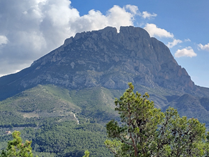
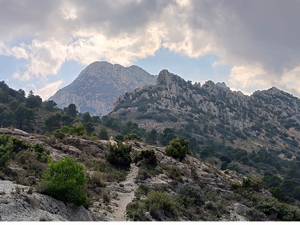
Monte Castellet Circuit
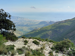
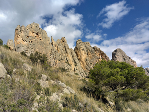
An interesting hike among spectacular scenery and rugged terrain in the southern mountains of the Costa Blanca.
Spanish maps included within these descriptions are provided courtesy of the Spanish IGN and remain © Instituto Geográfico Nacional.
OSM (OpenStreetMap) and OCM (OpenCycleMap) maps are © OpenStreetMap Contributors. The OSM project welcomes contributions from all to enrich the map data, which is made freely available. Land (Thunderforest Landscape) maps are © Thunderforest based on data © OpenStreetMap contributors.
The grade of this walk is VS/C, which means
VS – Very Strenuous: More than 800 metres ascent and/or more than 20km in length with steep, loose or heavily vegetated sections.
C – More than half the route on rough ground.
| Nearest town | Finestrat |
| Directions to start |
From Font Moli follow the road ahead and to the L, continue for 1.2km and park in small layby on LHS. |
| Start point (Lat/Long) | 38.583560, -0.213321 Click here to view in Google Maps (in a new browser tab) |
| Length (km) | 18.00 |
| Ascent (metres) | 850 |
| Walking time (hours) | 5.00 |
| Total time (hours) | 6.25 |
| Recommendations or Restrictions | Some navigational challenge and sections of neglected paths. |
Download walk descriptionDownload GPS file
Comments
Monte Castellet Circuit — No Comments
HTML tags allowed in your comment: <a href="" title=""> <abbr title=""> <acronym title=""> <b> <blockquote cite=""> <cite> <code> <del datetime=""> <em> <i> <q cite=""> <s> <strike> <strong>