
Montgo Two Summits
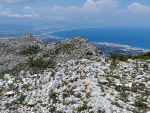
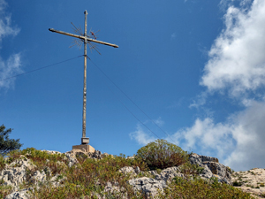
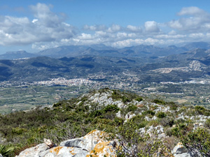
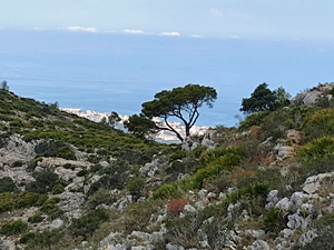
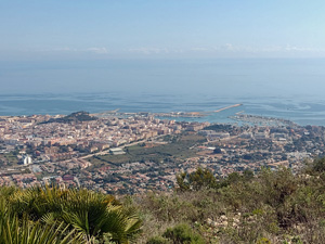
A clockwise route up Montgo taking in Denia Cross (summit) , the rocky ridge along to Javea Summit and return down the barranco below Penya de l’ Aguila. Relentless rocky paths rewarded by extensive views throughout.
Spanish maps included within these descriptions are provided courtesy of the Spanish IGN and remain © Instituto Geográfico Nacional.
OSM (OpenStreetMap) and OCM (OpenCycleMap) maps are © OpenStreetMap Contributors. The OSM project welcomes contributions from all to enrich the map data, which is made freely available. Land (Thunderforest Landscape) maps are © Thunderforest based on data © OpenStreetMap contributors.
The grade of this walk is S/C, which means
S – Strenuous: More than 600 metres ascent and/or more than 15km in length with steep, loose or heavily vegetated sections.
C – More than half the route on rough ground.
| Nearest town | Jesus Pobre |
| Directions to start |
Following the CV735 from La Xara to Javea, just past (20m) the turning on the RHS (CV738) to Jesus Pobre there is a minor road at LHS, take this and follow tarmac up to reach a disused sub-station building on LHS. Park here. |
| Start point (Lat/Long) | 38.806867, 0.092928 Click here to view in Google Maps (in a new browser tab) |
| Length (km) | 10.00 |
| Ascent (metres) | 640 |
| Walking time (hours) | 4.25 |
| Total time (hours) | 5 |
| Recommendations or Restrictions | The statistics underestimate the stamina /endurance necessary for this relentless rough and rocky terrain. |
Download walk descriptionDownload GPS file
Comments
Montgo Two Summits — No Comments
HTML tags allowed in your comment: <a href="" title=""> <abbr title=""> <acronym title=""> <b> <blockquote cite=""> <cite> <code> <del datetime=""> <em> <i> <q cite=""> <s> <strike> <strong>