
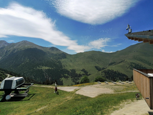
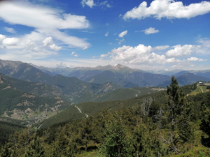
Pal Ski Station to Col de la Botella and back
A moderate out and back walk which avoids the ski runs to a scenic col with a nice restaurant for a snack or an ice cream. Great walk for acclimatising to Andorra’s altitude.
Spanish maps included within these descriptions are provided courtesy of the Spanish IGN and remain © Instituto Geográfico Nacional.
OSM (OpenStreetMap) and OCM (OpenCycleMap) maps are © OpenStreetMap Contributors. The OSM project welcomes contributions from all to enrich the map data, which is made freely available. Land (Thunderforest Landscape) maps are © Thunderforest based on data © OpenStreetMap contributors.
The grade of this walk is M/B, which means
M – Moderate: up to 12km in length, less than 400 metres ascent and less than 50% rough going.
B – Less than half the route on rough ground
| Nearest town | La Massana |
| Directions to start |
Car park at pal Ski Station reached by following CG4 from Erts passing Pal and then turn left after approx 2.5km at ski lift to rise up to main car park. Alternatively by using cable car from La Massana. |
| Start point (Lat/Long) | 42.537290, 1.491570 Click here to view in Google Maps (in a new browser tab) |
| Length (km) | 10.20 |
| Ascent (metres) | 380 |
| Walking time (hours) | 3 |
| Total time (hours) | 3.5 |
| Recommendations or Restrictions | Part of this route is shared with mountain bikers – stay vigilant! |
Download walk descriptionDownload GPS file
Comments
Pal Ski Station to Col de la Botella and back — No Comments
HTML tags allowed in your comment: <a href="" title=""> <abbr title=""> <acronym title=""> <b> <blockquote cite=""> <cite> <code> <del datetime=""> <em> <i> <q cite=""> <s> <strike> <strong>