
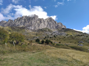
Pena Foratata from Formigal
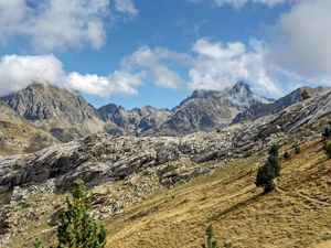
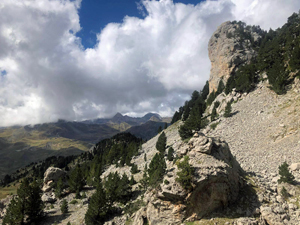
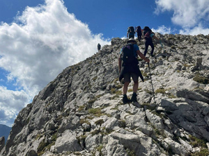
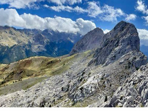
An easy walk to a mountain col followed by a trickier ridge walk with short scramble to an airy viewpoint. Fantastic scenery from the tops.
Spanish maps included within these descriptions are provided courtesy of the Spanish IGN and remain © Instituto Geográfico Nacional.
OSM (OpenStreetMap) and OCM (OpenCycleMap) maps are © OpenStreetMap Contributors. The OSM project welcomes contributions from all to enrich the map data, which is made freely available. Land (Thunderforest Landscape) maps are © Thunderforest based on data © OpenStreetMap contributors.
The grade of this walk is S/B/Scr, which means
S – Strenuous: More than 600 metres ascent and/or more than 15km in length with steep, loose or heavily vegetated sections.
B – Less than half the route on rough ground.
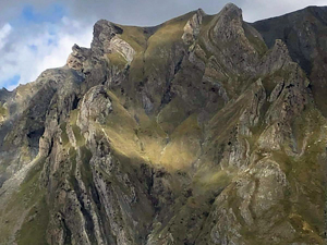
Scr – Scrambling: This implies the need for handholds to ascend steep rock pitches with a sense of exposure to vertigo and where a slip could lead to a serious accident.
| Nearest town | Formigal |
| Directions to start |
The N260 road skirts along the Pyrenean chain in Spain from E to W. At Biescas the A136 road heads N towards France to Formigal the last town before the French border. |
| Start point (Lat/Long) | 42.779150, -0.359160 Click here to view in Google Maps (in a new browser tab) |
| Length (km) | 8.00 |
| Ascent (metres) | 611 |
| Walking time (hours) | 2.66 |
| Total time (hours) | 4.5 |
| Recommendations or Restrictions | Minor exposure on the ridge with more considerable exposure on the rocky summit, |
Download walk descriptionDownload GPS file
Comments
Pena Foratata from Formigal — No Comments
HTML tags allowed in your comment: <a href="" title=""> <abbr title=""> <acronym title=""> <b> <blockquote cite=""> <cite> <code> <del datetime=""> <em> <i> <q cite=""> <s> <strike> <strong>