
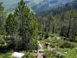
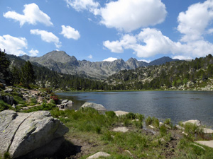
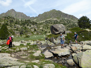
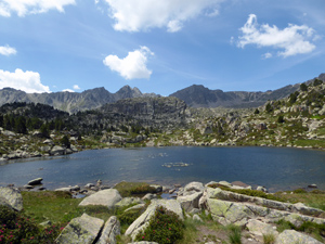
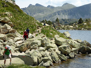
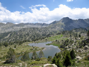
Pessons Lakes and Valleys
An easy to navigate circular walk passing numerous picturesque lakes with stunning mountain backdrops. Some climbing is steep and requires the occasional handhold. Maximum altitude 2,512m
Spanish maps included within these descriptions are provided courtesy of the Spanish IGN and remain © Instituto Geográfico Nacional.
OSM (OpenStreetMap) and OCM (OpenCycleMap) maps are © OpenStreetMap Contributors. The OSM project welcomes contributions from all to enrich the map data, which is made freely available. Land (Thunderforest Landscape) maps are © Thunderforest based on data © OpenStreetMap contributors.
The grade of this walk is MS/B, which means
MS – Moderately Strenuous: Up to 600 metres ascent and/or no more than 15 km in length with some rough going taken at a reasonable pace.
B – Less than half the route on rough ground
| Nearest town | Soldeu |
| Directions to start |
From Andorra la Vella, take CG2 passing Encamp and on to Soldeu. Continue towards Pas de la Casa but after passing roundabout to tunnel entrance, turn right signposted to Grau Roig. Park as closely as possible to the barrier placed to to prevent unauthorised traffic going further up the valley. |
| Start point (Lat/Long) | 42.531800, 1.696740 Click here to view in Google Maps (in a new browser tab) |
| Length (km) | 8.00 |
| Ascent (metres) | 440 |
| Walking time (hours) | 3 |
| Total time (hours) | 4 |
| Recommendations or Restrictions | A walk up to 2,500m so allow extra time if you are not used to the altitude. Parking might be a problem in very high season. Snow and ice can be encountered in Spring/early summer. Shuttle bus to the first lake only runs July/August. Area is used by mountain bikers – watch out for them! |
Download walk descriptionDownload GPS file
Comments
Pessons Lakes and Valleys — No Comments
HTML tags allowed in your comment: <a href="" title=""> <abbr title=""> <acronym title=""> <b> <blockquote cite=""> <cite> <code> <del datetime=""> <em> <i> <q cite=""> <s> <strike> <strong>