
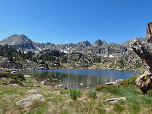
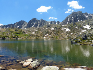
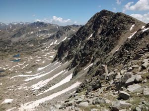
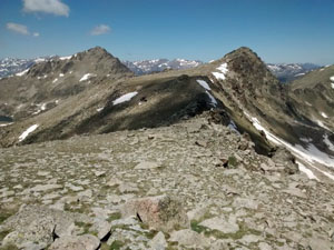
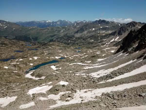
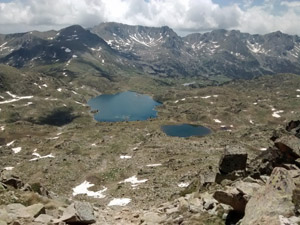
Pic de Pessons from Grau Roig
A fantastic walk up through the Pessons valley with a succession of sparkling lakes and babbling streams leading to a stiff climb up zig-zags to a col and then a short walk to a summit with 360 degree views.
Spanish maps included within these descriptions are provided courtesy of the Spanish IGN and remain © Instituto Geográfico Nacional.
OSM (OpenStreetMap) and OCM (OpenCycleMap) maps are © OpenStreetMap Contributors. The OSM project welcomes contributions from all to enrich the map data, which is made freely available. Land (Thunderforest Landscape) maps are © Thunderforest based on data © OpenStreetMap contributors.
The grade of this walk is VS/C, which means
VS – Very Strenuous: More than 800 metres ascent and/or more than 20km in length with steep, loose or heavily vegetated sections.
C – More than half the route on rough ground.
| Nearest town | Soldeu |
| Directions to start |
Entering Andorra from the S (in Spain) proceed up along the CG1 to Andorra la Vella and then the CG2 signed towards France. Continue through Soldeu and then find a turn on the RHS to the Grau Roig ski area. Continue ahead to park at the point nearest to the lifts. |
| Start point (Lat/Long) | 42.531710, 1.696336 Click here to view in Google Maps (in a new browser tab) |
| Length (km) | 13.00 |
| Ascent (metres) | 826 |
| Walking time (hours) | 4.5 |
| Total time (hours) | 7.5 |
| Recommendations or Restrictions | Tough mountain day. There is a 4 x 4 taxi that will take you the short distance up to the restaurant by the first lake but it is expensive for the distance! |
Download walk descriptionDownload GPS file
Comments
Pic de Pessons from Grau Roig — No Comments
HTML tags allowed in your comment: <a href="" title=""> <abbr title=""> <acronym title=""> <b> <blockquote cite=""> <cite> <code> <del datetime=""> <em> <i> <q cite=""> <s> <strike> <strong>