
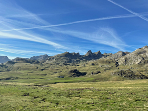
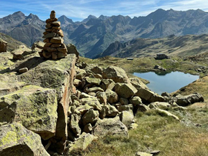
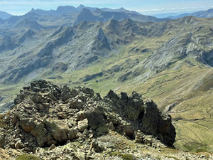
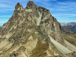
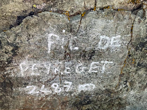
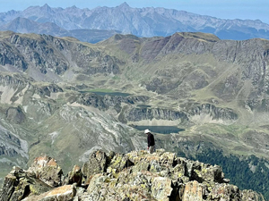
Pic de Peyreget circuit and summit
A high level mountain walk with a summit via the Refuge de Pombier (from where a return can be made if the summit is too difficult)
Spanish maps included within these descriptions are provided courtesy of the Spanish IGN and remain © Instituto Geográfico Nacional.
OSM (OpenStreetMap) and OCM (OpenCycleMap) maps are © OpenStreetMap Contributors. The OSM project welcomes contributions from all to enrich the map data, which is made freely available. Land (Thunderforest Landscape) maps are © Thunderforest based on data © OpenStreetMap contributors.
The grade of this walk is VS/B, which means
VS – Very Strenuous: More than 800 metres ascent and/or more than 20km in length with steep, loose or heavily vegetated sections.
B – Less than half the route on rough ground.
| Nearest town | Formigal |
| Directions to start |
The N260 road skirts along the Pyrenean chain in Spain from E to W. At Biescas the A136 road heads N towards France and reaches the Col at the border with France. Continue ahead on what is now the D934 road in France to reach extensive roadside parking on the RHS. |
| Start point (Lat/Long) | 42.814700, -0.418020 Click here to view in Google Maps (in a new browser tab) |
| Length (km) | 12.40 |
| Ascent (metres) | 912 |
| Walking time (hours) | 4 |
| Total time (hours) | 6.33 |
| Recommendations or Restrictions | Challenging route at altitude. Distances may vary depending on how far down the car park you start! |
Download walk descriptionDownload GPS file
Comments
Pic de Peyreget circuit and summit — No Comments
HTML tags allowed in your comment: <a href="" title=""> <abbr title=""> <acronym title=""> <b> <blockquote cite=""> <cite> <code> <del datetime=""> <em> <i> <q cite=""> <s> <strike> <strong>