
Pico el Escalar and Pico de Astun circuit
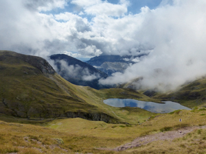
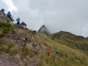
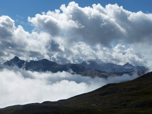
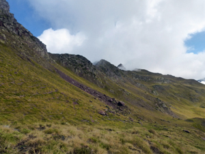
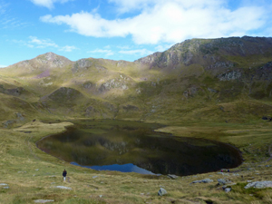
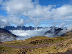
A cracking and challenging ridge walk with views across the Pyrenean chain and into France over a series of charming lakes.
Spanish maps included within these descriptions are provided courtesy of the Spanish IGN and remain © Instituto Geográfico Nacional.
OSM (OpenStreetMap) and OCM (OpenCycleMap) maps are © OpenStreetMap Contributors. The OSM project welcomes contributions from all to enrich the map data, which is made freely available. Land (Thunderforest Landscape) maps are © Thunderforest based on data © OpenStreetMap contributors.
The grade of this walk is MS/B, which means
MS – Moderately Strenuous: Up to 600 metres ascent and/or no more than 15 km in length with some rough going taken at a reasonable pace.
B – Less than half the route on rough ground
| Nearest town | Astun ski station |
| Directions to start |
This walk is written up on the basis that you can take the chair lift from Astun ski station to the top. This only runs (apart from skiing!) during the summer season and up to the middle weekend in September. Check for details. From Jaca take the road (A23) north towards France being careful to turn off to the R before the Somport tunnel and follow the “old” road towards Candanchu. Past this take a R turn signed to Astun and follow this to the end to reach the chair lift station. |
| Start point (Lat/Long) | 42.809471, -0.506969 Click here to view in Google Maps (in a new browser tab) |
| Length (km) | 8.00 |
| Ascent (metres) | 495 |
| Walking time (hours) | 2.66 |
| Total time (hours) | 4.75 |
| Recommendations or Restrictions | Some scrambling. Breathlessness possible because of the altitude. |
Download walk descriptionDownload GPS file
Comments
Pico el Escalar and Pico de Astun circuit — No Comments
HTML tags allowed in your comment: <a href="" title=""> <abbr title=""> <acronym title=""> <b> <blockquote cite=""> <cite> <code> <del datetime=""> <em> <i> <q cite=""> <s> <strike> <strong>