
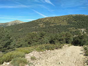
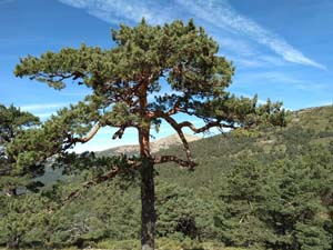
Puerto del Fuenfria and Pena del Aguila
An interesting walk up an old Roman road before a high mountain ridge and easy woodland return. Extensive views.
Spanish maps included within these descriptions are provided courtesy of the Spanish IGN and remain © Instituto Geográfico Nacional.
OSM (OpenStreetMap) and OCM (OpenCycleMap) maps are © OpenStreetMap Contributors. The OSM project welcomes contributions from all to enrich the map data, which is made freely available. Land (Thunderforest Landscape) maps are © Thunderforest based on data © OpenStreetMap contributors.
The grade of this walk is S/B, which means
S – Strenuous: More than 600 metres ascent and/or more than 15km in length with steep, loose or heavily vegetated sections.
B – Less than half the route on rough ground.
| Nearest town | Cercedilla |
| Directions to start |
Cercedilla is reached to the NW of Madrid from the AP6 motorway at junction 47. The M614 and M622 lead to the village with the railway station on the outskirts. |
| Start point (Lat/Long) | 40.771055, -4.068116 Click here to view in Google Maps (in a new browser tab) |
| Length (km) | 14.00 |
| Ascent (metres) | 780 |
| Walking time (hours) | 4.25 |
| Total time (hours) | 6 |
| Recommendations or Restrictions | Avoid attempting this at week-ends, public holidays and during summer months when ALL of the nearby car parks will be packed to capacity. |
Download walk descriptionDownload GPS file
Comments
Puerto del Fuenfria and Pena del Aguila — No Comments
HTML tags allowed in your comment: <a href="" title=""> <abbr title=""> <acronym title=""> <b> <blockquote cite=""> <cite> <code> <del datetime=""> <em> <i> <q cite=""> <s> <strike> <strong>