
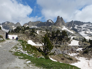
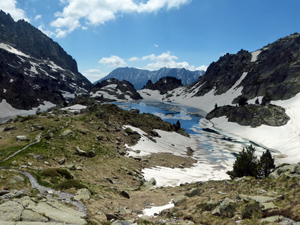
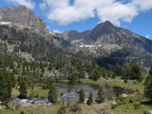
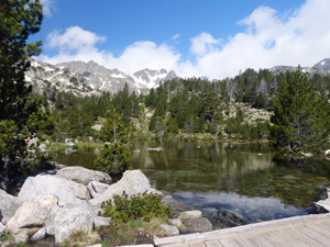
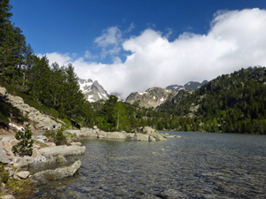
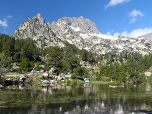
Refugio d’Amitges circuit from Estany de Sant Maurici
Using the many 4 x 4 taxis from Espot makes it easier for us to gain access to these high mountain fastnesses quite easily. The scenery all day is stunning.
Spanish maps included within these descriptions are provided courtesy of the Spanish IGN and remain © Instituto Geográfico Nacional.
OSM (OpenStreetMap) and OCM (OpenCycleMap) maps are © OpenStreetMap Contributors. The OSM project welcomes contributions from all to enrich the map data, which is made freely available. Land (Thunderforest Landscape) maps are © Thunderforest based on data © OpenStreetMap contributors.
The grade of this walk is MS/B, which means
MS – Moderately Strenuous: Up to 600 metres ascent and/or no more than 15 km in length with some rough going taken at a reasonable pace.
B – Less than half the route on rough ground
| Nearest town | Espot |
| Directions to start |
From the mid N of Spain find the C13 road heading N from Sort. Turn L on the LV50014 at the S end of Panta de la Torrossa – a large reservoir and drive to Espot. |
| Start point (Lat/Long) | 42.582199, 1.011710 Click here to view in Google Maps (in a new browser tab) |
| Length (km) | 11.00 |
| Ascent (metres) | 570 |
| Walking time (hours) | 4 |
| Total time (hours) | 6 |
| Recommendations or Restrictions | Use group taxi from Espot – €9 rtn in 2018 |
Download walk descriptionDownload GPS file
Comments
Refugio d’Amitges circuit from Estany de Sant Maurici — No Comments
HTML tags allowed in your comment: <a href="" title=""> <abbr title=""> <acronym title=""> <b> <blockquote cite=""> <cite> <code> <del datetime=""> <em> <i> <q cite=""> <s> <strike> <strong>