
Riberers Circuit
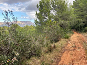
This walk is named after the Riberers or labourers who used this track when harvesting produce. The start is a gentle 4km before starting to climb. most of the walk is on good tracks except rocky and rough underfoot near the peak of Serrellars.
Spanish maps included within these descriptions are provided courtesy of the Spanish IGN and remain © Instituto Geográfico Nacional.
OSM (OpenStreetMap) and OCM (OpenCycleMap) maps are © OpenStreetMap Contributors. The OSM project welcomes contributions from all to enrich the map data, which is made freely available. Land (Thunderforest Landscape) maps are © Thunderforest based on data © OpenStreetMap contributors.
The grade of this walk is MS/A, which means
MS – Moderately Strenuous: Up to 600 metres ascent and/or no more than 15 km in length with some rough going taken at a reasonable pace.
A – All on good tracks
| Nearest town | Benissa |
| Directions to start |
Benissa 38.7312051, 0.0556632 On the roundabout in Benissa take the exit before the AP7 slip road (Partida Bonaire)signed Cemetery, after 150 metres turn left at sign, after 200 metres turn left at T junction onto Cami de Canor. |
| Start point (Lat/Long) | 38.731205, 0.055663 Click here to view in Google Maps (in a new browser tab) |
| Length (km) | 14.00 |
| Ascent (metres) | 323 |
| Walking time (hours) | 5 |
| Total time (hours) | 5.5 |
| Recommendations or Restrictions | None |
Download walk descriptionDownload GPS file
Comments
Riberers Circuit — No Comments
HTML tags allowed in your comment: <a href="" title=""> <abbr title=""> <acronym title=""> <b> <blockquote cite=""> <cite> <code> <del datetime=""> <em> <i> <q cite=""> <s> <strike> <strong>