
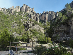
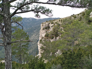
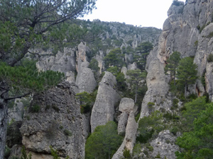
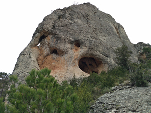
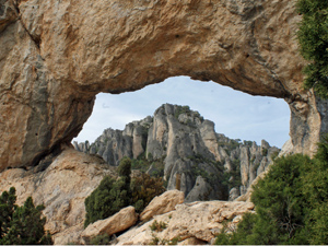
Roca Xapada circuit
An easy start leads to a challenging scramble along the ridge and then easier ground with views of rock pinnacles all around. Finish with a cave or rock hole (Forat).
Spanish maps included within these descriptions are provided courtesy of the Spanish IGN and remain © Instituto Geográfico Nacional.
OSM (OpenStreetMap) and OCM (OpenCycleMap) maps are © OpenStreetMap Contributors. The OSM project welcomes contributions from all to enrich the map data, which is made freely available. Land (Thunderforest Landscape) maps are © Thunderforest based on data © OpenStreetMap contributors.
The grade of this walk is MS/B/Scr, which means
MS – Moderately Strenuous: Up to 600 metres ascent and/or no more than 15 km in length with some rough going taken at a reasonable pace.
B – Less than half the route on rough ground
Scr – Scrambling: This implies the need for handholds to ascend steep rock pitches with a sense of exposure to vertigo and where a slip could lead to a serious accident.
| Nearest town | Mas de Barberans |
| Directions to start |
Head for Mas de Barberans on the TV3421. From the N pass the village and 3 kms after passing Mas de Barberans turn right (L and before the village if coming from the S), signposted ‘Cami de la Barranc de la Galera and La Vall’. Continue along here as the tarmac vanishes and proceed along a track for 5.2km to reach the parking for Cova d’en Marc where you can leave a car. The picnic parking is a further 1.2km further up the track on the LHS. |
| Start point (Lat/Long) | 40.751535, 0.321370 Click here to view in Google Maps (in a new browser tab) |
| Length (km) | 7.50 |
| Ascent (metres) | 535 |
| Walking time (hours) | 2.5 |
| Total time (hours) | 4.5 |
| Recommendations or Restrictions | Car shuffle needed from the first bridge crossing at the Raco and up to the picnic area further up the track on the LHS. Moderate scrambling from the first col. An easier but equally rewarding version without scrambling, is a there and back route from the small Raco d’en Marc parking. |
Download walk descriptionDownload GPS file

Comments
Roca Xapada circuit — No Comments
HTML tags allowed in your comment: <a href="" title=""> <abbr title=""> <acronym title=""> <b> <blockquote cite=""> <cite> <code> <del datetime=""> <em> <i> <q cite=""> <s> <strike> <strong>