
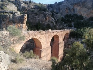
Ruta del Agua and Peña Cortada
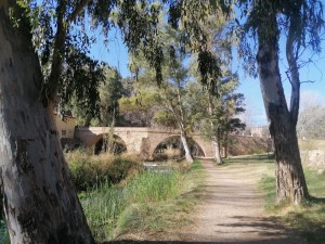
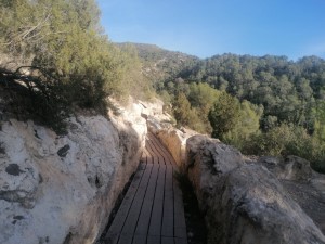
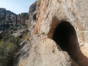
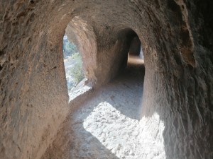
A circular walk along the river Tuejar passing the village Calles, the Peña Cortado gorge, Roman water channels & Aqueduct before descending through the town of Chelva back to the car park.
Spanish maps included within these descriptions are provided courtesy of the Spanish IGN and remain © Instituto Geográfico Nacional.
OSM (OpenStreetMap) and OCM (OpenCycleMap) maps are © OpenStreetMap Contributors. The OSM project welcomes contributions from all to enrich the map data, which is made freely available. Land (Thunderforest Landscape) maps are © Thunderforest based on data © OpenStreetMap contributors.
The grade of this walk is MS/B, which means
MS – Moderately Strenuous: Up to 600 metres ascent and/or no more than 15 km in length with some rough going taken at a reasonable pace.
B – Less than half the route on rough ground
| Nearest town | Chelva |
| Directions to start |
From Valencia bypass (A/7 Junction 324) take CV35 towards Ademuz.. After approx 60km pass through village of Chelva and cross narrow bridge then take next turn very sharply left: signposted Ruta del Agua. Drive 3 minutes downhill to parking Ruta del Agua (1.4km) |
| Start point (Lat/Long) | 39.745840, -1.004200 Click here to view in Google Maps (in a new browser tab) |
| Length (km) | 13.00 |
| Ascent (metres) | 700 |
| Walking time (hours) | 3hrs 20m |
| Total time (hours) | 5hrs 10m |
| Recommendations or Restrictions | Torch useful for use in tunnels, particularly if you are tall. |
Download walk descriptionDownload GPS file
Comments
Ruta del Agua and Peña Cortada — No Comments
HTML tags allowed in your comment: <a href="" title=""> <abbr title=""> <acronym title=""> <b> <blockquote cite=""> <cite> <code> <del datetime=""> <em> <i> <q cite=""> <s> <strike> <strong>