
Sedella circuit
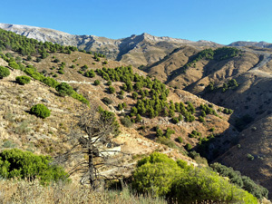
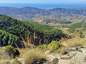
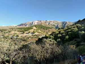
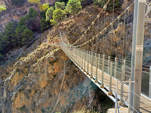
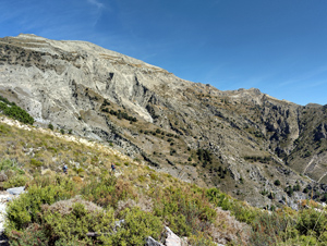
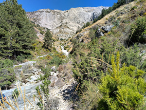
A long circular hike around the Monticara plateau, Saltilla gorge to Canillas de Aceituna via GR249 cross the Puente Colgante (hanging bridge) and return to Sedella on undulating tracks .. varied scenery of riverbeds, the surrounding peaks including La Maroma and extensive views down to the coastline
Spanish maps included within these descriptions are provided courtesy of the Spanish IGN and remain © Instituto Geográfico Nacional.
OSM (OpenStreetMap) and OCM (OpenCycleMap) maps are © OpenStreetMap Contributors. The OSM project welcomes contributions from all to enrich the map data, which is made freely available. Land (Thunderforest Landscape) maps are © Thunderforest based on data © OpenStreetMap contributors.
The grade of this walk is VS/C, which means
VS – Very Strenuous: More than 800 metres ascent and/or more than 20km in length with steep, loose or heavily vegetated sections.
C – More than half the route on rough ground.
| Nearest town | Sedella |
| Directions to start |
MA-126 from Sedella towards Canillas de Aceituna, on the outskirts of Sedella village on RH bend turn L (signed Piscina) onto cami . del Arroyo de Matanzas and park in car park at LHS |
| Start point (Lat/Long) | 36.862744, -4.037498 Click here to view in Google Maps (in a new browser tab) |
| Length (km) | 23.50 |
| Ascent (metres) | 1300 |
| Walking time (hours) | 7 |
| Total time (hours) | 9 |
| Recommendations or Restrictions | None |
Download walk descriptionDownload GPS file
Comments
Sedella circuit — No Comments
HTML tags allowed in your comment: <a href="" title=""> <abbr title=""> <acronym title=""> <b> <blockquote cite=""> <cite> <code> <del datetime=""> <em> <i> <q cite=""> <s> <strike> <strong>