
Serra d’Aixorta – Barranco Mates, Raco de la Figuera and Font Major circuit
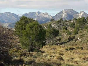
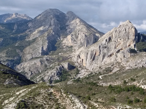
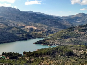
A beautiful tranquil walk on good paths with excellent views of Guadalest reservoir, down to the coast, across to Aitana and varying interesting features
Spanish maps included within these descriptions are provided courtesy of the Spanish IGN and remain © Instituto Geográfico Nacional.
OSM (OpenStreetMap) and OCM (OpenCycleMap) maps are © OpenStreetMap Contributors. The OSM project welcomes contributions from all to enrich the map data, which is made freely available. Land (Thunderforest Landscape) maps are © Thunderforest based on data © OpenStreetMap contributors.
The grade of this walk is VS/B, which means
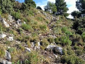
VS – Very Strenuous: More than 800 metres ascent and/or more than 20km in length with steep, loose or heavily vegetated sections.
B – Less than half the route on rough ground.
| Nearest town | Beniarda |
| Directions to start |
From Guadalest on CV70 through Benimantell and turn R at next junction to Beniarda. Drive through village and continue (narrow road) and turn L near PR finger post, cross ford, ignore R fork, reach next junction and park hear at LHS. |
| Start point (Lat/Long) | 38.697732, -0.211448 Click here to view in Google Maps (in a new browser tab) |
| Length (km) | 15.00 |
| Ascent (metres) | 900 |
| Walking time (hours) | 5 |
| Total time (hours) | 5.5 |
| Recommendations or Restrictions | None |
Download walk descriptionDownload GPS file
Comments
Serra d’Aixorta – Barranco Mates, Raco de la Figuera and Font Major circuit — No Comments
HTML tags allowed in your comment: <a href="" title=""> <abbr title=""> <acronym title=""> <b> <blockquote cite=""> <cite> <code> <del datetime=""> <em> <i> <q cite=""> <s> <strike> <strong>