
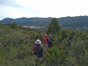
Serra de Mostalla
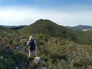
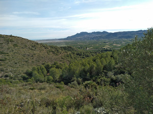
A circuit from Pego over this intermediate ridge with wide views N and S with an easy start and finish. Could be a pre lunch walk!
Spanish maps included within these descriptions are provided courtesy of the Spanish IGN and remain © Instituto Geográfico Nacional.
OSM (OpenStreetMap) and OCM (OpenCycleMap) maps are © OpenStreetMap Contributors. The OSM project welcomes contributions from all to enrich the map data, which is made freely available. Land (Thunderforest Landscape) maps are © Thunderforest based on data © OpenStreetMap contributors.
The grade of this walk is MS/B, which means
MS – Moderately Strenuous: Up to 600 metres ascent and/or no more than 15 km in length with some rough going taken at a reasonable pace.
B – Less than half the route on rough ground
| Nearest town | Pego |
| Directions to start |
Approaching from Denia on the CV700 at the Coop petrol station turn R at the roundabout. Proceed over 2 more roundabouts and at a T-jnc turn L. Proceed past Mercadona on your LHS and take the next R into Via Pista. Proceed for 1.15km approx., turn sharp left, staying on Via Pista. Starting point is about 350m further down this road. |
| Start point (Lat/Long) | 38.857775, -0.116087 Click here to view in Google Maps (in a new browser tab) |
| Length (km) | 10.30 |
| Ascent (metres) | 420 |
| Walking time (hours) | 3.33 |
| Total time (hours) | 4.25 |
| Recommendations or Restrictions | None |
Download walk descriptionDownload GPS file
Comments
Serra de Mostalla — No Comments
HTML tags allowed in your comment: <a href="" title=""> <abbr title=""> <acronym title=""> <b> <blockquote cite=""> <cite> <code> <del datetime=""> <em> <i> <q cite=""> <s> <strike> <strong>