
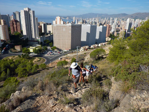
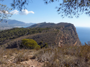
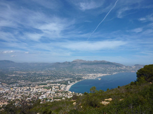
Sierra Helada from Benidorm (bus shuttle)
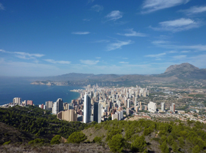
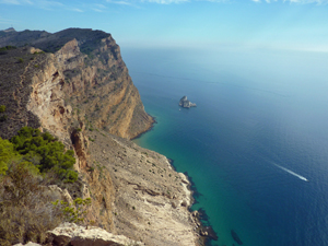
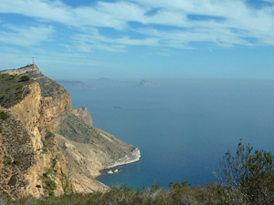
A cliff walk with spectacular views from Benidorm to Altea. Most of the route is over quite rough ground but on well marked and defined paths. Some minor scrambling and some descents are loose underfoot.
Spanish maps included within these descriptions are provided courtesy of the Spanish IGN and remain © Instituto Geográfico Nacional.
OSM (OpenStreetMap) and OCM (OpenCycleMap) maps are © OpenStreetMap Contributors. The OSM project welcomes contributions from all to enrich the map data, which is made freely available. Land (Thunderforest Landscape) maps are © Thunderforest based on data © OpenStreetMap contributors.
The grade of this walk is S/B, which means
S – Strenuous: More than 600 metres ascent and/or more than 15km in length with steep, loose or heavily vegetated sections.
B – Less than half the route on rough ground.
| Nearest town | Benidorm |
| Directions to start |
3 km south of Altea at traffic light controlled roundabout at km 153.5 on N332 (Avenida Europa) in Albir turn towards centre Albir (signposted “Playa del Albir) on Avenida de L’Albir (CV 753). At first roundabout after 380 metres take first exit signposted to “Playa del Albir”. After 80 metres keep left at major interesection. Continue for 0.5km to Supermercado “Consum” and park behind it. (Not in customer parking). Park car and walk to the front of Supermercado “Consum” and cross the road to catch the bus number 10 near cafe “Malibu” (good coffee). Bus runs every 20 mins and costs €1,55 in 2020. Have coins ready for driver as you enter at front of bus – notes are not welcome. |
| Start point (Lat/Long) | 38.540000, -0.104470 Click here to view in Google Maps (in a new browser tab) |
| Length (km) | 8.50 |
| Ascent (metres) | 670 |
| Walking time (hours) | 3.25 |
| Total time (hours) | 5 |
| Recommendations or Restrictions | The route is quite short but it is quite tough with a lot of very broken trail. There are no water sources throughout and in summer there is little shade. |
Download walk descriptionDownload GPS file
Tried this today but access from the top of Paris is no longer possible due to building works, path blocked by fence
The route author will check this out as soon as possible and we will update with more info. Thanks for letting us know.
These works are passable. The route author has updated both the description and the gps track to show how to pass this difficulty.