
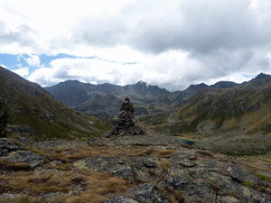
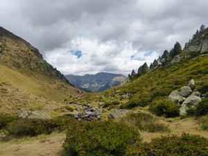
Tristaigne cirque
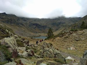
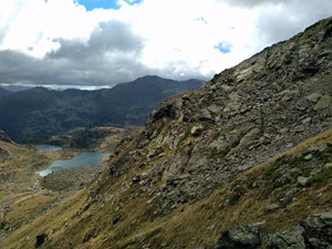
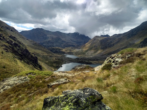
Fantastic scenery all around the Tristaigne cirque comes at the cost of challenging rock hopping and difficult terrain. Don’t be fooled by the low stats – this is a challenging walk, but worth the effort!
Spanish maps included within these descriptions are provided courtesy of the Spanish IGN and remain © Instituto Geográfico Nacional.
OSM (OpenStreetMap) and OCM (OpenCycleMap) maps are © OpenStreetMap Contributors. The OSM project welcomes contributions from all to enrich the map data, which is made freely available. Land (Thunderforest Landscape) maps are © Thunderforest based on data © OpenStreetMap contributors.
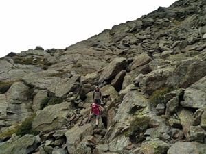
The grade of this walk is MS/C/Scr, which means
MS – Moderately Strenuous: Up to 600 metres ascent and/or no more than 15 km in length with some rough going taken at a reasonable pace.
C – More than half the route on rough ground.
Scr – Scrambling: This implies the need for handholds to ascend steep rock pitches with a sense of exposure to vertigo and where a slip could lead to a serious accident.
| Nearest town | El Serrat |
| Directions to start |
Starting from the CG2 main road through Andorra, take the CG3 from Les Escaldes through the tunnel (free) and on to Ordino. Follow this road on through El Serrat shortly after which it mysteriously becomes the CS380. In summer months it is often shut at the Arcalis ski station from where you should take the telecabina up to the higher station at the restaurant la Borda. |
| Start point (Lat/Long) | 42.631676, 1.481539 Click here to view in Google Maps (in a new browser tab) |
| Length (km) | 7.00 |
| Ascent (metres) | 550 |
| Walking time (hours) | 2.75 |
| Total time (hours) | 4.25 |
| Recommendations or Restrictions | Some simple scrambling required |
Download walk descriptionDownload GPS file
Comments
Tristaigne cirque — No Comments
HTML tags allowed in your comment: <a href="" title=""> <abbr title=""> <acronym title=""> <b> <blockquote cite=""> <cite> <code> <del datetime=""> <em> <i> <q cite=""> <s> <strike> <strong>