
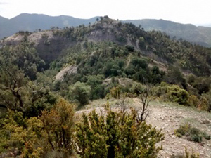
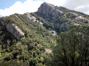
Vilada circuit to Serra de Migdia
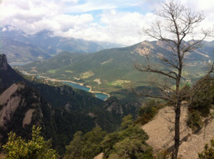
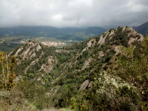
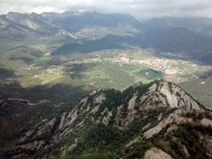
A steep walk up through woodland with revealing views of jagged mountain tops leading to the summit of Serra del Migdia and a return through woodland and along a river.
Spanish maps included within these descriptions are provided courtesy of the Spanish IGN and remain © Instituto Geográfico Nacional.
OSM (OpenStreetMap) and OCM (OpenCycleMap) maps are © OpenStreetMap Contributors. The OSM project welcomes contributions from all to enrich the map data, which is made freely available. Land (Thunderforest Landscape) maps are © Thunderforest based on data © OpenStreetMap contributors.
The grade of this walk is S/B, which means
S – Strenuous: More than 600 metres ascent and/or more than 15km in length with steep, loose or heavily vegetated sections.
B – Less than half the route on rough ground.
| Nearest town | Vilada |
| Directions to start |
From the C16 road travelling N towards the Cadi tunnel turn R towards Vilada on the C26. Pass through the village of Vilada and continue down through zig-zags to cross a river. A little way after this (about 1.5km) look out of a track doubling back on the R signed to Canals de San Miguel. |
| Start point (Lat/Long) | 42.129480, 1.940248 Click here to view in Google Maps (in a new browser tab) |
| Length (km) | 9.00 |
| Ascent (metres) | 700 |
| Walking time (hours) | 3.00 |
| Total time (hours) | 4.25 |
| Recommendations or Restrictions | Very steep paths are encountered on this walk! |
Download walk descriptionDownload GPS file
Comments
Vilada circuit to Serra de Migdia — No Comments
HTML tags allowed in your comment: <a href="" title=""> <abbr title=""> <acronym title=""> <b> <blockquote cite=""> <cite> <code> <del datetime=""> <em> <i> <q cite=""> <s> <strike> <strong>