
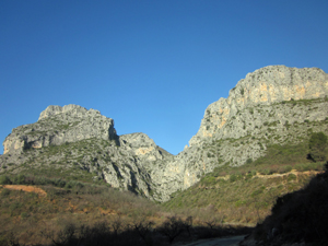
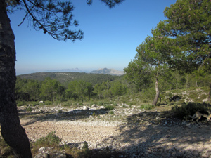
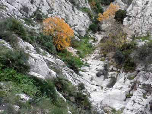
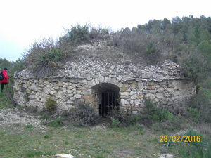
Barrancos Calvo and Malafi
A varied walk in this scenic area, some tough scrambling, forest tracks, paths and historic landmarks with extensive views.
Spanish maps included within these descriptions are provided courtesy of the Spanish IGN and remain © Instituto Geográfico Nacional.
OSM (OpenStreetMap) and OCM (OpenCycleMap) maps are © OpenStreetMap Contributors. The OSM project welcomes contributions from all to enrich the map data, which is made freely available. Land (Thunderforest Landscape) maps are © Thunderforest based on data © OpenStreetMap contributors.
The grade of this walk is S/C/Scr, which means
S – Strenuous: More than 600 metres ascent and/or more than 15km in length with steep, loose or heavily vegetated sections.
C – More than half the route on rough ground.
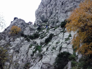
Scr – Scrambling: This implies the need for handholds to ascend steep rock pitches with a sense of exposure to vertigo and where a slip could lead to a serious accident.
| Nearest town | Benichembla |
| Directions to start |
CV720 from Benichembla to Castells road at Km6, turn R near Villa Mercedes (signed Petracos) and continue for 4km and park on layby at RHS of road. |
| Start point (Lat/Long) | 38.769781, -0.194966 Click here to view in Google Maps (in a new browser tab) |
| Length (km) | 16.70 |
| Ascent (metres) | 500 |
| Walking time (hours) | 4.50 |
| Total time (hours) | 6 |
| Recommendations or Restrictions | Includes some sections of rough rock scrambling. |
Download walk descriptionDownload GPS file

Comments
Barrancos Calvo and Malafi — No Comments
HTML tags allowed in your comment: <a href="" title=""> <abbr title=""> <acronym title=""> <b> <blockquote cite=""> <cite> <code> <del datetime=""> <em> <i> <q cite=""> <s> <strike> <strong>