
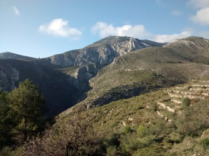
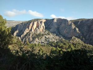
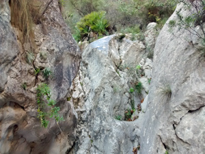
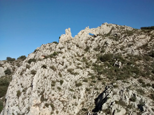
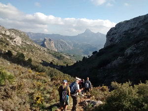
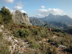
Barranco Xarquet
The lack of height gain and distance should not lead you to underestimate the challenge of this day which involves a demanding scramble up the barranco (great fun!) leading to fruit terraces and an easier return back through a valley with coastal views.
Spanish maps included within these descriptions are provided courtesy of the Spanish IGN and remain © Instituto Geográfico Nacional.
OSM (OpenStreetMap) and OCM (OpenCycleMap) maps are © OpenStreetMap Contributors. The OSM project welcomes contributions from all to enrich the map data, which is made freely available. Land (Thunderforest Landscape) maps are © Thunderforest based on data © OpenStreetMap contributors.
The grade of this walk is MS/C/Scr, which means
MS – Moderately Strenuous: Up to 600 metres ascent and/or no more than 15 km in length with some rough going taken at a reasonable pace.
C – More than half the route on rough ground.
Scr – Scrambling: This implies the need for handholds to ascend steep rock pitches with a sense of exposure to vertigo and where a slip could lead to a serious accident.
| Nearest town | Bolulla |
| Directions to start |
CV715 Bolulla to Tarbena road, at km.46 turn L and wind up to reach renovated house and park just below in olive orchard on RHS |
| Start point (Lat/Long) | 38.694131, -0.127991 Click here to view in Google Maps (in a new browser tab) |
| Length (km) | 10.00 |
| Ascent (metres) | 410 |
| Walking time (hours) | 3.00 |
| Total time (hours) | 4.50 |
| Recommendations or Restrictions | An ability for hand scrambling with small amount of exposure |
Download walk descriptionDownload GPS file
Comments
Barranco Xarquet — No Comments
HTML tags allowed in your comment: <a href="" title=""> <abbr title=""> <acronym title=""> <b> <blockquote cite=""> <cite> <code> <del datetime=""> <em> <i> <q cite=""> <s> <strike> <strong>