
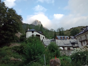
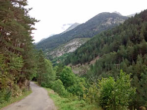
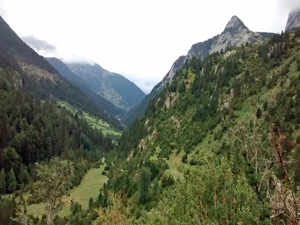
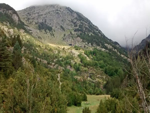
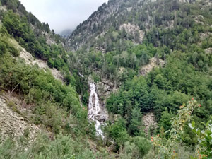
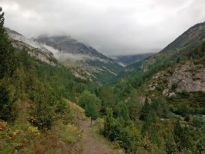
GR11 – Day 15. Sallent de Gallego to Refugio Respomuso
A moderate walk in to the higher Pyrenees as part of the GR11. Fantastic scenery later in the day.
Spanish maps included within these descriptions are provided courtesy of the Spanish IGN and remain © Instituto Geográfico Nacional.
OSM (OpenStreetMap) and OCM (OpenCycleMap) maps are © OpenStreetMap Contributors. The OSM project welcomes contributions from all to enrich the map data, which is made freely available. Land (Thunderforest Landscape) maps are © Thunderforest based on data © OpenStreetMap contributors.
The grade of this walk is VS/B, which means
VS – Very Strenuous: More than 800 metres ascent and/or more than 20km in length with steep, loose or heavily vegetated sections.
B – Less than half the route on rough ground.
| Nearest town | Sallent de Gallego |
| Directions to start |
Starting from Jaca in northern Spain, travel E towards Sabinanigo and then N on the N260 and the A136 to reach the village on the RHS before the border with France! |
| Start point (Lat/Long) | 42.771819, -0.330974 Click here to view in Google Maps (in a new browser tab) |
| Length (km) | 12.00 |
| Ascent (metres) | 1299 |
| Walking time (hours) | 3.25 |
| Total time (hours) | 4.00 |
| Recommendations or Restrictions | Linear walk. Have to stay at Refugio. GPX data may overstate ascent and descent (from mobile phone) |
Download walk descriptionDownload GPS file
Comments
GR11 – Day 15. Sallent de Gallego to Refugio Respomuso — No Comments
HTML tags allowed in your comment: <a href="" title=""> <abbr title=""> <acronym title=""> <b> <blockquote cite=""> <cite> <code> <del datetime=""> <em> <i> <q cite=""> <s> <strike> <strong>