
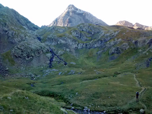
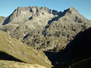
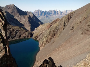
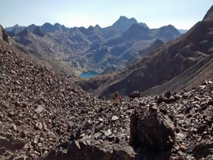
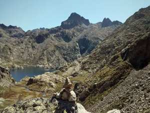
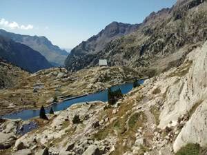
GR11 – Day 16. Refugio Respomuso to Banos de Panticosa
A walk across a high Pyrenean ridge reaching almost 2800m. Far reaching views and fantastic but demanding scenery.
Spanish maps included within these descriptions are provided courtesy of the Spanish IGN and remain © Instituto Geográfico Nacional.
OSM (OpenStreetMap) and OCM (OpenCycleMap) maps are © OpenStreetMap Contributors. The OSM project welcomes contributions from all to enrich the map data, which is made freely available. Land (Thunderforest Landscape) maps are © Thunderforest based on data © OpenStreetMap contributors.
The grade of this walk is VS/C/X, which means
VS – Very Strenuous: More than 800 metres ascent and/or more than 20km in length with steep, loose or heavily vegetated sections.
C – More than half the route on rough ground.
X – Experienced walkers route: the route requires considerable stamina and/or significant scrambling skills on rough, steep or exposed sections.
| Nearest town | Sallent de Gallego |
| Directions to start |
The Refugio Respomuso is in a remote location that can only be reached by a prior walk from Sallent de Gallego. Part of the GR11 long distance walk. |
| Start point (Lat/Long) | 42.817099, -0.287770 Click here to view in Google Maps (in a new browser tab) |
| Length (km) | 13.00 |
| Ascent (metres) | 0 |
| Walking time (hours) | 4.75 |
| Total time (hours) | 6.50 |
| Recommendations or Restrictions | Linear walk. There is a road to Banos de Panticosa so you can exit from here if you have transport. The scramble to the Collado de Piedrafita requires no fear of exposure!
Risk of snow in the early summer. |
Download walk descriptionDownload GPS file
Comments
GR11 – Day 16. Refugio Respomuso to Banos de Panticosa — No Comments
HTML tags allowed in your comment: <a href="" title=""> <abbr title=""> <acronym title=""> <b> <blockquote cite=""> <cite> <code> <del datetime=""> <em> <i> <q cite=""> <s> <strike> <strong>