
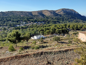
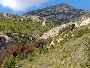
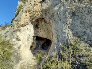
La Mamelleta, Font Cova del Roget circuit
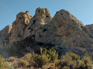
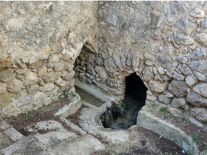
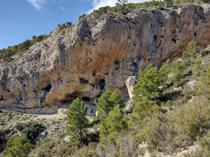
An interesting low altitude hike with extensive views, three summits, a ridge, a font, a cave, a small scramble, some ‘ off piste ‘ but mostly good paths
Spanish maps included within these descriptions are provided courtesy of the Spanish IGN and remain © Instituto Geográfico Nacional.
OSM (OpenStreetMap) and OCM (OpenCycleMap) maps are © OpenStreetMap Contributors. The OSM project welcomes contributions from all to enrich the map data, which is made freely available. Land (Thunderforest Landscape) maps are © Thunderforest based on data © OpenStreetMap contributors.
The grade of this walk is S/C/Scr, which means
S – Strenuous: More than 600 metres ascent and/or more than 15km in length with steep, loose or heavily vegetated sections.
C – More than half the route on rough ground.
Scr – Scrambling: This implies the need for handholds to ascend steep rock pitches with a sense of exposure to vertigo and where a slip could lead to a serious accident.
| Nearest town | La Nucia |
| Directions to start |
CV758 La Nucia to Finestrat, from La Nucia direction after Km3 sign continue to Gas Cylinder Depot at RHS and turn L into narrow lane, cross a junction then park on open ground at LHS |
| Start point (Lat/Long) | 38.570429, -0.166370 Click here to view in Google Maps (in a new browser tab) |
| Length (km) | 12.00 |
| Ascent (metres) | 750 |
| Walking time (hours) | 3.66 |
| Total time (hours) | 5 |
| Recommendations or Restrictions | Good Navigational skills required |
Download walk descriptionDownload GPS file
Comments
La Mamelleta, Font Cova del Roget circuit — No Comments
HTML tags allowed in your comment: <a href="" title=""> <abbr title=""> <acronym title=""> <b> <blockquote cite=""> <cite> <code> <del datetime=""> <em> <i> <q cite=""> <s> <strike> <strong>