
Cavall Bernat via Creu del Cadenal
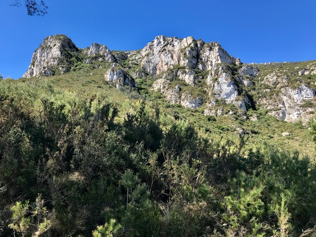
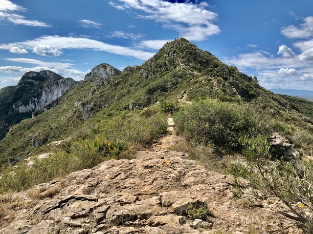
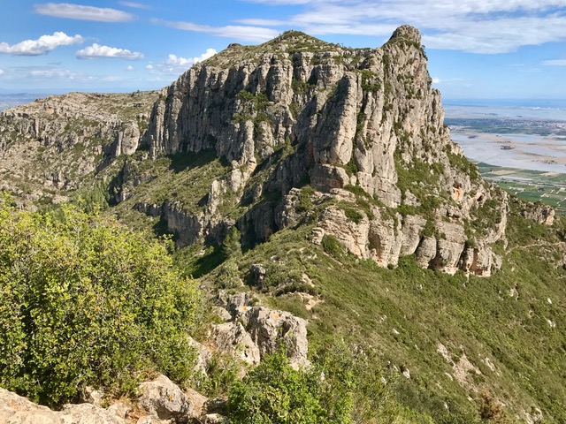
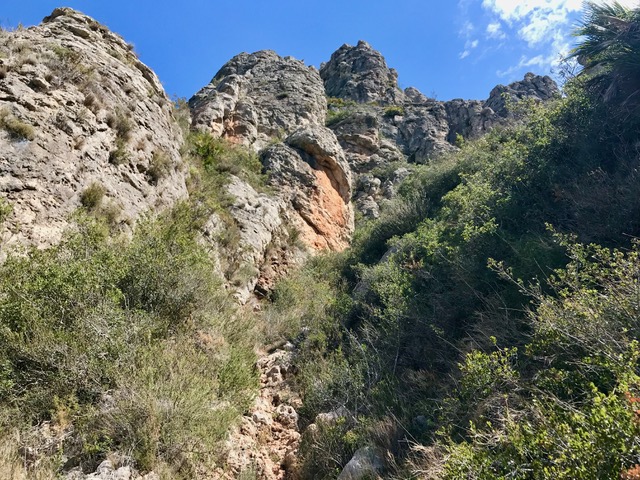
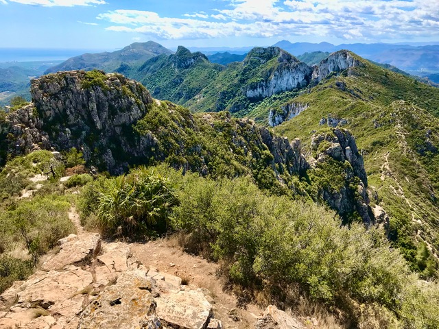
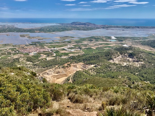
Ascend through steep woodland and shrubbery to the open ridge at Pas de Sant Sofi. Scramble up to the Crue del Cardinal (optional). Regain the col and scramble up the imposing looking peak of Cavall Bernat on an improbable and complex route via a hidden cannal (gully). Descend by more straightforward paths. Steep and rough in places, but no real exposure. Wonderful views of mountains and the Valencian plains.
Options. the route can be followed to only include the Crue del Cardinal and then reversed, for which the scrambling is minimal. Reducing walking time to approx 3hrs 20min, distance to 7km, ascent to 600m and grade to MS/C/Scr. Alternatively, the visit to the cross can be missed out. Though savings are minimal.
Spanish maps included within these descriptions are provided courtesy of the Spanish IGN and remain © Instituto Geográfico Nacional.
OSM (OpenStreetMap) and OCM (OpenCycleMap) maps are © OpenStreetMap Contributors. The OSM project welcomes contributions from all to enrich the map data, which is made freely available. Land (Thunderforest Landscape) maps are © Thunderforest based on data © OpenStreetMap contributors.
The grade of this walk is VS/C/Scr, which means
VS – Very Strenuous: More than 800 metres ascent and/or more than 20km in length with steep, loose or heavily vegetated sections.
C – More than half the route on rough ground.
Scr – Scrambling: This implies the need for handholds to ascend steep rock pitches with a sense of exposure to vertigo and where a slip could lead to a serious accident.
| Nearest town | Llauri |
| Directions to start |
Leave AP 7 at junction 59 towards Favara. At roundabout turn R onto N332. In centre of Favara turn R onto CV-510. Go straight on to Llauri. At roundabout enter town, then turn L signed to Polideportivo, then 2nd right into C’ De Sant Vincent Ferrer, turn 2nd left along C’ Poble Nou. Follow it directly to Poble Nou. Park on roadside near playground with walk information board opposite. |
| Start point (Lat/Long) | 39.138990, -0.331780 Click here to view in Google Maps (in a new browser tab) |
| Length (km) | 10.00 |
| Ascent (metres) | 880 |
| Walking time (hours) | 4 hrs |
| Total time (hours) | 6 hrs |
| Recommendations or Restrictions | The route over Cavall Bernat may be difficult to follow in cloudy conditions and treacherously slippery when wet. Not recommend with dogs. |
Download walk descriptionDownload GPS file
Comments
Cavall Bernat via Creu del Cadenal — No Comments
HTML tags allowed in your comment: <a href="" title=""> <abbr title=""> <acronym title=""> <b> <blockquote cite=""> <cite> <code> <del datetime=""> <em> <i> <q cite=""> <s> <strike> <strong>