
Alt de Petillo & Mirador Pantano
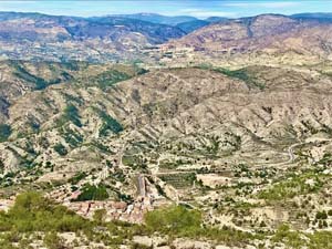
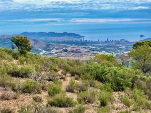
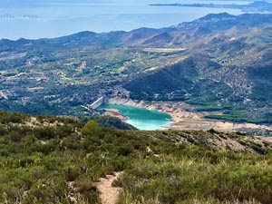
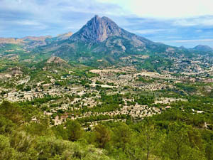
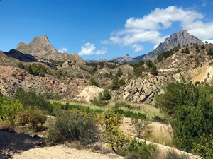
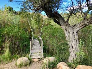
This hulk of a mountain, towers over Orxeta. This is a circuit of its northern end, leading up to the summit and along to the mirador Pantano, then back over the summit and down the western flank. The terrain is very rugged and often steep. Some paths, especially on the descent are eroded and loose. The views from the approach are superb as are those from the Mirador Pantano.
Spanish maps included within these descriptions are provided courtesy of the Spanish IGN and remain © Instituto Geográfico Nacional.
OSM (OpenStreetMap) and OCM (OpenCycleMap) maps are © OpenStreetMap Contributors. The OSM project welcomes contributions from all to enrich the map data, which is made freely available. Land (Thunderforest Landscape) maps are © Thunderforest based on data © OpenStreetMap contributors.
The grade of this walk is MS/C, which means
MS – Moderately Strenuous: Up to 600 metres ascent and/or no more than 15 km in length with some rough going taken at a reasonable pace.
C – More than half the route on rough ground.
| Nearest town | Orxeta |
| Directions to start |
Coming from the coast near Villajoyosa (junction 658 on AP7) follow CV-770 north to Orxeta. Drive through village to northern end. Turn right into Carrer Barranquet (beside walk information boards) then immediately left into car park. If arriving from the north on CV-770, turn left off the righthand bend as soon as the village is reached and left again into the car park. |
| Start point (Lat/Long) | 38.565270, -0.262330 Click here to view in Google Maps (in a new browser tab) |
| Length (km) | 10.00 |
| Ascent (metres) | 577 |
| Walking time (hours) | 4 |
| Total time (hours) | 5.5 |
| Recommendations or Restrictions |
Download walk descriptionDownload GPS file
Comments
Alt de Petillo & Mirador Pantano — No Comments
HTML tags allowed in your comment: <a href="" title=""> <abbr title=""> <acronym title=""> <b> <blockquote cite=""> <cite> <code> <del datetime=""> <em> <i> <q cite=""> <s> <strike> <strong>