
Bco Sinc from Font del L’Hortet del Pobre
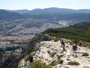
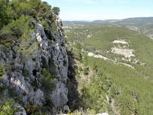
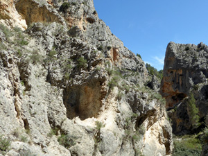
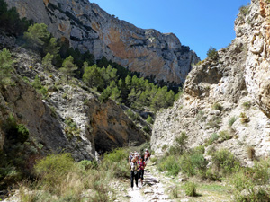
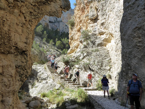
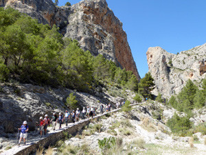
A circular route on well defined paths. A stiff climb up to the Ermita is followed by a spectacular trail along the rim of the barranco past the Vulture lookout. A sharp descent then a return path back through the base of the barranco before a climb back to the start
Spanish maps included within these descriptions are provided courtesy of the Spanish IGN and remain © Instituto Geográfico Nacional.
OSM (OpenStreetMap) and OCM (OpenCycleMap) maps are © OpenStreetMap Contributors. The OSM project welcomes contributions from all to enrich the map data, which is made freely available. Land (Thunderforest Landscape) maps are © Thunderforest based on data © OpenStreetMap contributors.
The grade of this walk is MS/B, which means
MS – Moderately Strenuous: Up to 600 metres ascent and/or no more than 15 km in length with some rough going taken at a reasonable pace.
B – Less than half the route on rough ground
| Nearest town | Alcoy |
| Directions to start |
From Autopista A7 Salida 443 take N340 (Alcoy Nord) |
| Start point (Lat/Long) | 38.701550, -0.493447 Click here to view in Google Maps (in a new browser tab) |
| Length (km) | 8.00 |
| Ascent (metres) | 483 |
| Walking time (hours) | 3 |
| Total time (hours) | 4 |
| Recommendations or Restrictions | The barranco name “Sinc” appears on maps as “Zinc”, “Cint” and “Bou”. I have no idea which is correct!
Vultures tend to soar when there are air currents to give them lift. As the day warms up there are more thermals and so early walking is not great for raptor watching. |
Download walk descriptionDownload GPS file
Comments
Bco Sinc from Font del L’Hortet del Pobre — No Comments
HTML tags allowed in your comment: <a href="" title=""> <abbr title=""> <acronym title=""> <b> <blockquote cite=""> <cite> <code> <del datetime=""> <em> <i> <q cite=""> <s> <strike> <strong>