
Senda Del Toro
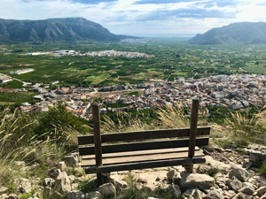
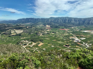
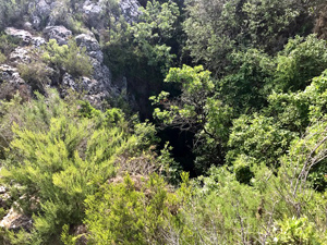
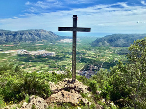
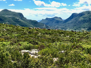
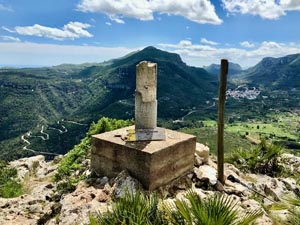
A steady climb to a mirador. Then a steep section with awkward rock steps. A diversion to a Sima and another to the Cross. Good paths all Y/W lead to the Alt de Mirador. A branch path G/W leads extremely steeply over rough, awkward, rocky terrain down to a Col. Good paths lead back to the town. Fine views.
There are variations available, these are noted in the full description.
Spanish maps included within these descriptions are provided courtesy of the Spanish IGN and remain © Instituto Geográfico Nacional.
OSM (OpenStreetMap) and OCM (OpenCycleMap) maps are © OpenStreetMap Contributors. The OSM project welcomes contributions from all to enrich the map data, which is made freely available. Land (Thunderforest Landscape) maps are © Thunderforest based on data © OpenStreetMap contributors.
The grade of this walk is S/C, which means
S – Strenuous: More than 600 metres ascent and/or more than 15km in length with steep, loose or heavily vegetated sections.
C – More than half the route on rough ground.
| Nearest town | Simat de la Valldigna. |
| Directions to start |
From roundabout on CV-600 at edge of town turn L onto CV-675 bypass. At roundabout turn first R across a bridge, at mini roundabout turn R and park along side of road. Start at mini roundabout next to bus shelter beside information board. There is also parking at tourist information office but it is often full. |
| Start point (Lat/Long) | 39.044090, -0.308740 Click here to view in Google Maps (in a new browser tab) |
| Length (km) | 9.60 |
| Ascent (metres) | 655 |
| Walking time (hours) | 4 |
| Total time (hours) | 6 |
| Recommendations or Restrictions | The steep descent at 6km is not suitable for dogs and would be dangerous when wet. |
Download walk descriptionDownload GPS file
Comments
Senda Del Toro — No Comments
HTML tags allowed in your comment: <a href="" title=""> <abbr title=""> <acronym title=""> <b> <blockquote cite=""> <cite> <code> <del datetime=""> <em> <i> <q cite=""> <s> <strike> <strong>