
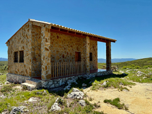
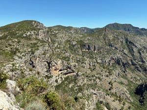
Alt de la Lletrera and Els Miradors
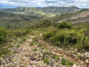
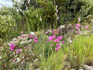
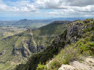
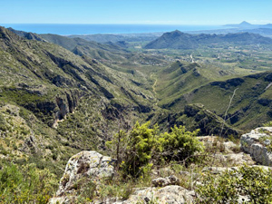
Essentially this is a there and back walk with a few deviations. Crossing wild open, peaceful countryside above the small, somewhat isolated, village of Pinet. Lots of straightforward tracks and paths, though much of the route is unmarked. Passing through an area of Botanical interest. Some terrific views, particularly from the mirador. An abundance of flowers in the spring.
Spanish maps included within these descriptions are provided courtesy of the Spanish IGN and remain © Instituto Geográfico Nacional.
OSM (OpenStreetMap) and OCM (OpenCycleMap) maps are © OpenStreetMap Contributors. The OSM project welcomes contributions from all to enrich the map data, which is made freely available. Land (Thunderforest Landscape) maps are © Thunderforest based on data © OpenStreetMap contributors.
The grade of this walk is MS/C, which means
MS – Moderately Strenuous: Up to 600 metres ascent and/or no more than 15 km in length with some rough going taken at a reasonable pace.
C – More than half the route on rough ground.
| Nearest town | Pinet |
| Directions to start |
From the CV-610 in Llutxent take the CV-608 to Pinet. Park at the roadside just before entering the village. |
| Start point (Lat/Long) | 38.981560, -0.337630 Click here to view in Google Maps (in a new browser tab) |
| Length (km) | 13.00 |
| Ascent (metres) | 562 |
| Walking time (hours) | 4.5 |
| Total time (hours) | 6 |
| Recommendations or Restrictions | You should remain quiet and not linger when passing the bee hives. |
Download walk descriptionDownload GPS file
Comments
Alt de la Lletrera and Els Miradors — No Comments
HTML tags allowed in your comment: <a href="" title=""> <abbr title=""> <acronym title=""> <b> <blockquote cite=""> <cite> <code> <del datetime=""> <em> <i> <q cite=""> <s> <strike> <strong>