
Forna Countrside
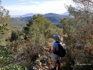
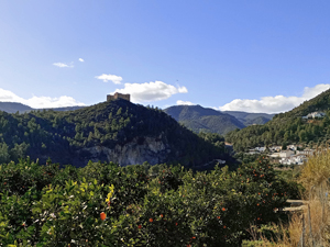
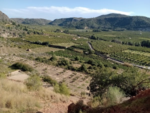
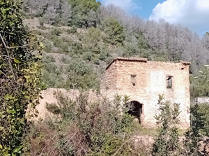
Go through the village. ascend a steep rocky path (great views of the valley and Forna castle) to reach the high point of the day. Continue on good paths through woodland to descend to a track. Lunch is usually taken at a point just off the track at the edge of a dry barranco. From there descend further on a path which is steep in parts to reach the road soon ascending gently back to the village
Spanish maps included within these descriptions are provided courtesy of the Spanish IGN and remain © Instituto Geográfico Nacional.
OSM (OpenStreetMap) and OCM (OpenCycleMap) maps are © OpenStreetMap Contributors. The OSM project welcomes contributions from all to enrich the map data, which is made freely available. Land (Thunderforest Landscape) maps are © Thunderforest based on data © OpenStreetMap contributors.
The grade of this walk is M/B, which means
M – Moderate: up to 12km in length, less than 400 metres ascent and less than 50% rough going.
B – Less than half the route on rough ground
| Nearest town | Forna |
| Directions to start |
Arriving from Pego and through Adsubia take the RH turn on the CV717 to Forna. Park in the car park on the outskirts of the village before reaching the narrow village roads. |
| Start point (Lat/Long) | 38.873369, -0.172262 Click here to view in Google Maps (in a new browser tab) |
| Length (km) | 8.20 |
| Ascent (metres) | 335 |
| Walking time (hours) | 4 |
| Total time (hours) | 4.5 |
| Recommendations or Restrictions | Although a low grade some of the woodland paths are steep. |
Download walk descriptionDownload GPS file
Comments
Forna Countrside — No Comments
HTML tags allowed in your comment: <a href="" title=""> <abbr title=""> <acronym title=""> <b> <blockquote cite=""> <cite> <code> <del datetime=""> <em> <i> <q cite=""> <s> <strike> <strong>