
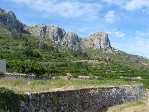
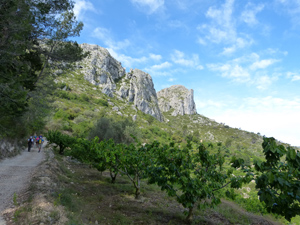
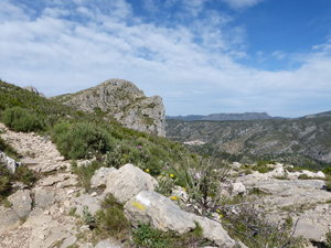
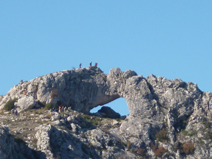
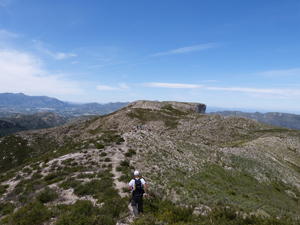
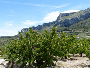
Forada ridge circuit from Benissiva
A terrific walk along this ridge with an early opportunity to explore the Forada – a magnificent hole in the ridge line which you can pass through or over – as the fancy and your nerves dictate!
Spanish maps included within these descriptions are provided courtesy of the Spanish IGN and remain © Instituto Geográfico Nacional.
OSM (OpenStreetMap) and OCM (OpenCycleMap) maps are © OpenStreetMap Contributors. The OSM project welcomes contributions from all to enrich the map data, which is made freely available. Land (Thunderforest Landscape) maps are © Thunderforest based on data © OpenStreetMap contributors.
The grade of this walk is VS/C/X, which means
VS – Very Strenuous: More than 800 metres ascent and/or more than 20km in length with steep, loose or heavily vegetated sections.
C – More than half the route on rough ground.
X – Experienced walkers route: the route requires considerable stamina and/or significant scrambling skills on rough, steep or exposed sections.
| Nearest town | Benissiva |
| Directions to start |
CV700 km 53.5 Pego to Planes road. Park behind Co-op in Benissiva (on right just as you enter the village) |
| Start point (Lat/Long) | 38.819540, -0.225273 Click here to view in Google Maps (in a new browser tab) |
| Length (km) | 17.00 |
| Ascent (metres) | 950 |
| Walking time (hours) | 6 |
| Total time (hours) | 6.5 |
| Recommendations or Restrictions | None |
Download walk descriptionDownload GPS file
Comments
Forada ridge circuit from Benissiva — No Comments
HTML tags allowed in your comment: <a href="" title=""> <abbr title=""> <acronym title=""> <b> <blockquote cite=""> <cite> <code> <del datetime=""> <em> <i> <q cite=""> <s> <strike> <strong>