
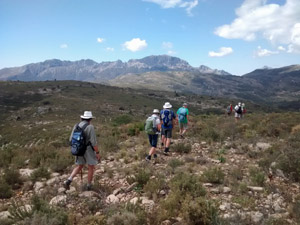
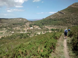
Penyas Mica, Ample and Barranco del Cau (Waterhouses)
A tough walk along the less frequented ridge of Alt d’Ample, a visit to the Iris gardens and unusual tracks to return via Barranco del Cau.
Spanish maps included within these descriptions are provided courtesy of the Spanish IGN and remain © Instituto Geográfico Nacional.
OSM (OpenStreetMap) and OCM (OpenCycleMap) maps are © OpenStreetMap Contributors. The OSM project welcomes contributions from all to enrich the map data, which is made freely available. Land (Thunderforest Landscape) maps are © Thunderforest based on data © OpenStreetMap contributors.
The grade of this walk is S/C/Scr, which means
S – Strenuous: More than 600 metres ascent and/or more than 15km in length with steep, loose or heavily vegetated sections.
C – More than half the route on rough ground.
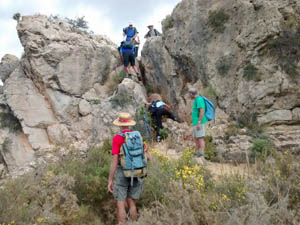
Scr – Scrambling: This implies the need for handholds to ascend steep rock pitches with a sense of exposure to vertigo and where a slip could lead to a serious accident.
| Nearest town | Jalon |
| Directions to start |
From the middle of Jalon along the calle Major take the CV749 towards Bernia. After 1km park at the substantial ruin on the RHS just after crossing a bridge. |
| Start point (Lat/Long) | 38.730483, -0.015413 Click here to view in Google Maps (in a new browser tab) |
| Length (km) | 16.00 |
| Ascent (metres) | 700 |
| Walking time (hours) | 4.50 |
| Total time (hours) | 6.00 |
| Recommendations or Restrictions | Some scrambling and rough going involved. |
Download walk descriptionDownload GPS file
Comments
Penyas Mica, Ample and Barranco del Cau (Waterhouses) — No Comments
HTML tags allowed in your comment: <a href="" title=""> <abbr title=""> <acronym title=""> <b> <blockquote cite=""> <cite> <code> <del datetime=""> <em> <i> <q cite=""> <s> <strike> <strong>