
GR 11 Day 1
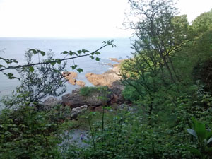
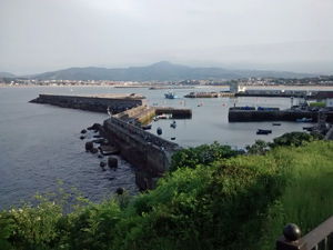
A necessary excursion to start the GR11 so that you can say you started from the sea!! Nothing much to commend it as a walk save the diversion to look at the old town of Hondarribia.
Spanish maps included within these descriptions are provided courtesy of the Spanish IGN and remain © Instituto Geográfico Nacional.
OSM (OpenStreetMap) and OCM (OpenCycleMap) maps are © OpenStreetMap Contributors. The OSM project welcomes contributions from all to enrich the map data, which is made freely available. Land (Thunderforest Landscape) maps are © Thunderforest based on data © OpenStreetMap contributors.
The grade of this walk is E/A, which means
E – Easy: A walk of up to 4½ hours on good surfaced tracks and less than 200 metres ascent.
A – All on good tracks
| Nearest town | Irun |
| Directions to start |
From Irun – the best town for accommodation it is best either to take a taxi (about €15 in 2014) from the railway station, or to take a bus (E25) part way and then to walk the rest. |
| Start point (Lat/Long) | 43.391503, -1.792182 Click here to view in Google Maps (in a new browser tab) |
| Length (km) | 7.80 |
| Ascent (metres) | 100 |
| Walking time (hours) | 1.50 |
| Total time (hours) | 1.75 |
| Recommendations or Restrictions | None |
Download walk descriptionDownload GPS file
Comments
GR 11 Day 1 — No Comments
HTML tags allowed in your comment: <a href="" title=""> <abbr title=""> <acronym title=""> <b> <blockquote cite=""> <cite> <code> <del datetime=""> <em> <i> <q cite=""> <s> <strike> <strong>