
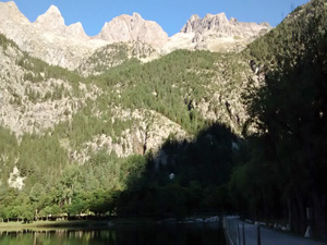
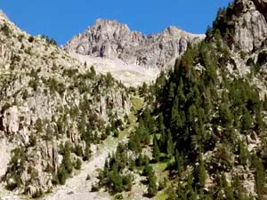
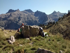
Ibones de Ordicuso de las Ranas
A delightful excursion up to remote lakes below a cirque of mountains.
Spanish maps included within these descriptions are provided courtesy of the Spanish IGN and remain © Instituto Geográfico Nacional.
OSM (OpenStreetMap) and OCM (OpenCycleMap) maps are © OpenStreetMap Contributors. The OSM project welcomes contributions from all to enrich the map data, which is made freely available. Land (Thunderforest Landscape) maps are © Thunderforest based on data © OpenStreetMap contributors.
The grade of this walk is MS/B, which means
MS – Moderately Strenuous: Up to 600 metres ascent and/or no more than 15 km in length with some rough going taken at a reasonable pace.
B – Less than half the route on rough ground
| Nearest town | Banos de Panticosa |
| Directions to start |
Starting from Jaca in northern Spain, travel E towards Sabinanigo and then N on the N260 and the A136 to turn R onto the A2606 initially to Panticosa and then onwards to Banos de Panticosa. The car park is reached by turning L just after the reservoir end and then R at the far side. |
| Start point (Lat/Long) | 42.759785, -0.235616 Click here to view in Google Maps (in a new browser tab) |
| Length (km) | 5.50 |
| Ascent (metres) | 600 |
| Walking time (hours) | 2.00 |
| Total time (hours) | 3.00 |
| Recommendations or Restrictions | None |
Download walk descriptionDownload GPS file
Comments
Ibones de Ordicuso de las Ranas — No Comments
HTML tags allowed in your comment: <a href="" title=""> <abbr title=""> <acronym title=""> <b> <blockquote cite=""> <cite> <code> <del datetime=""> <em> <i> <q cite=""> <s> <strike> <strong>