
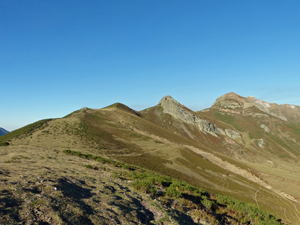
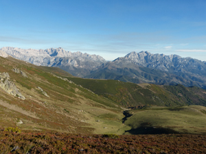
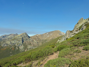
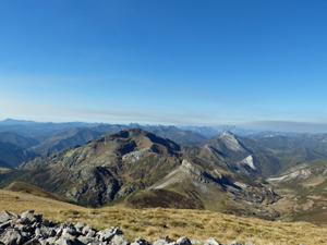
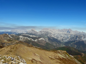
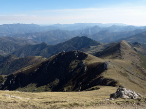
Coriscao summit from Collado de Llesba
A magnificent ridge walk with views both into the heart of the Picos de Europa and both E and W across the outstretched Cordillera Cantabrica.
Spanish maps included within these descriptions are provided courtesy of the Spanish IGN and remain © Instituto Geográfico Nacional.
OSM (OpenStreetMap) and OCM (OpenCycleMap) maps are © OpenStreetMap Contributors. The OSM project welcomes contributions from all to enrich the map data, which is made freely available. Land (Thunderforest Landscape) maps are © Thunderforest based on data © OpenStreetMap contributors.
The grade of this walk is S/B, which means
S – Strenuous: More than 600 metres ascent and/or more than 15km in length with steep, loose or heavily vegetated sections.
B – Less than half the route on rough ground.
| Nearest town | Collado de Llesba |
| Directions to start |
Follow the N621 S and rising steadily from Potes for 27km to reach the Puerto de San Glorio and here turn R up a minor road to its end at the Collado de Llesba. Park here. Room for about 10 cars. |
| Start point (Lat/Long) | 43.076454, -4.749634 Click here to view in Google Maps (in a new browser tab) |
| Length (km) | 9.00 |
| Ascent (metres) | 602 |
| Walking time (hours) | 3 |
| Total time (hours) | 4.33 |
| Recommendations or Restrictions | The high altitude may make you feel that you are walking slower than normally. Take your time – it;s the altitude. If a headache arrives and worsens, retreat. |
Download walk descriptionDownload GPS file
Comments
Coriscao summit from Collado de Llesba — No Comments
HTML tags allowed in your comment: <a href="" title=""> <abbr title=""> <acronym title=""> <b> <blockquote cite=""> <cite> <code> <del datetime=""> <em> <i> <q cite=""> <s> <strike> <strong>