
Tarbena Algar valley circuit
Warning – this route is very difficult to pass in the early sections due to vegetation growth and general neglect. It may be re-written in the future.
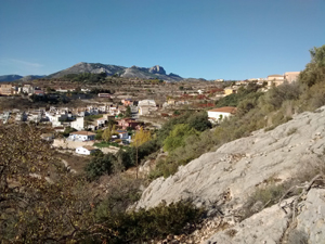
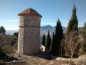
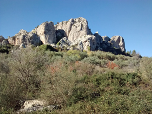
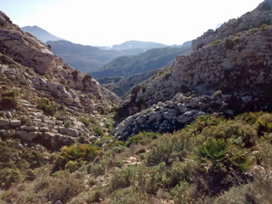
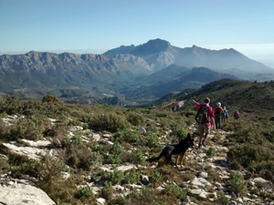
A beautiful and scenic walk through some of the Algar valley, ascend up to the Carrascal Parcent ridge and enjoy the impressive views and mozz/arabic path on the return.
Spanish maps included within these descriptions are provided courtesy of the Spanish IGN and remain © Instituto Geográfico Nacional.
OSM (OpenStreetMap) and OCM (OpenCycleMap) maps are © OpenStreetMap Contributors. The OSM project welcomes contributions from all to enrich the map data, which is made freely available. Land (Thunderforest Landscape) maps are © Thunderforest based on data © OpenStreetMap contributors.
The grade of this walk is VS/C/X, which means
VS – Very Strenuous: More than 800 metres ascent and/or more than 20km in length with steep, loose or heavily vegetated sections.
C – More than half the route on rough ground.
X – Experienced walkers route: the route requires considerable stamina and/or significant scrambling skills on rough, steep or exposed sections.
| Nearest town | Tarbena |
| Directions to start |
From the North, take the CV715 from Parcent, over the Col de Rates and onwards towards Tárbena. Pass the turning to Castell de Castells and at the outskirts of the village on a bend continue straight ahead and uphill into Avenida Eusebio Signes. At the top of the rise, turn sharp right to the car park near the Casa Cultura & Museum. Ample free parking. (Museum open weekends from 1100hrs). |
| Start point (Lat/Long) | 38.694984, -0.103601 Click here to view in Google Maps (in a new browser tab) |
| Length (km) | 19.50 |
| Ascent (metres) | 1030 |
| Walking time (hours) | 5.25 |
| Total time (hours) | 6.66 |
| Recommendations or Restrictions | Demanding day partly across open mountain side. |
Download walk descriptionDownload GPS file
Comments
Tarbena Algar valley circuit — No Comments
HTML tags allowed in your comment: <a href="" title=""> <abbr title=""> <acronym title=""> <b> <blockquote cite=""> <cite> <code> <del datetime=""> <em> <i> <q cite=""> <s> <strike> <strong>