
Les Foies to Cim del Penyalba Circuit
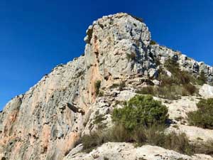
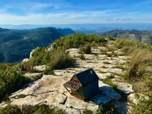
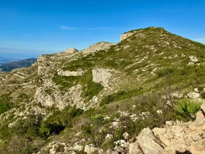
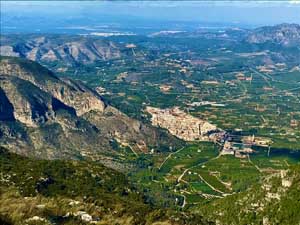
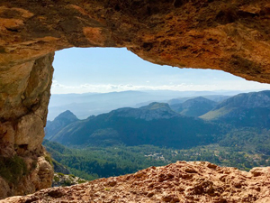
Going via a Font to gain a fine open ridge. Visiting a Forat. Then along an exposed scrambling section (optional). Crossing subsidiary tops & finally up some unavoidable but very easy scrambling, to reach the summit of Cim del Penyalba. The views are extensive. Descending the easy scrambling, leads more directly back to Font Nova. Mostly on paths, many are rugged & in places steep & rocky!
Spanish maps included within these descriptions are provided courtesy of the Spanish IGN and remain © Instituto Geográfico Nacional.
OSM (OpenStreetMap) and OCM (OpenCycleMap) maps are © OpenStreetMap Contributors. The OSM project welcomes contributions from all to enrich the map data, which is made freely available. Land (Thunderforest Landscape) maps are © Thunderforest based on data © OpenStreetMap contributors.
The grade of this walk is MS/C/Scr, which means
MS – Moderately Strenuous: Up to 600 metres ascent and/or no more than 15 km in length with some rough going taken at a reasonable pace.
C – More than half the route on rough ground.
Scr – Scrambling: This implies the need for handholds to ascend steep rock pitches with a sense of exposure to vertigo and where a slip could lead to a serious accident.
| Nearest town | Barx |
| Directions to start |
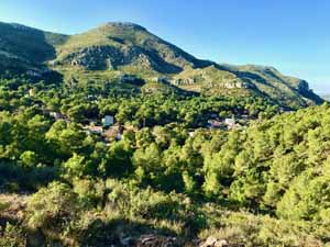
Les Foies. From the CV-675 about 1km beyond Barx in the direction of Simat de la Valldigna, between kilometres 13 &14. Turn north, signed to Les Foies onto a minor road. Follow this dramatic drive for 3.5km. Take the R fork in the village, to reach Font Nova. Parking for several cars. Large parties may prefer to park in Barx next to the roundabout at Lat: 39.0111, Long: -0.2995 and car share for the 12 minute drive to the font. |
| Start point (Lat/Long) | 39.021000, -0.281100 Click here to view in Google Maps (in a new browser tab) |
| Length (km) | 9.00 |
| Ascent (metres) | 500 |
| Walking time (hours) | 3 |
| Total time (hours) | 5 |
| Recommendations or Restrictions | The scrambling and the summit rocks would be very slippery when wet! Navigation on the summit in thick cloud/mist, could be difficult and potentially dangerous. |
Download walk descriptionDownload GPS file
Comments
Les Foies to Cim del Penyalba Circuit — No Comments
HTML tags allowed in your comment: <a href="" title=""> <abbr title=""> <acronym title=""> <b> <blockquote cite=""> <cite> <code> <del datetime=""> <em> <i> <q cite=""> <s> <strike> <strong>