
Moleta de les Canals circuit from Sant Roc
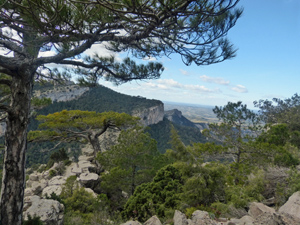
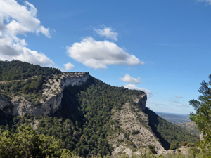
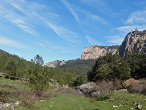
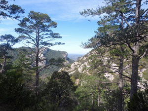
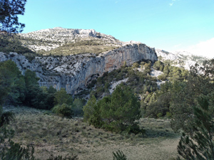
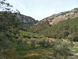
A circuit of one of the main summits in the area using excellent paths and tracks with wide ranging views and craggy cliffs predominating.
Spanish maps included within these descriptions are provided courtesy of the Spanish IGN and remain © Instituto Geográfico Nacional.
OSM (OpenStreetMap) and OCM (OpenCycleMap) maps are © OpenStreetMap Contributors. The OSM project welcomes contributions from all to enrich the map data, which is made freely available. Land (Thunderforest Landscape) maps are © Thunderforest based on data © OpenStreetMap contributors.
The grade of this walk is VS/A, which means
VS – Very Strenuous: More than 800 metres ascent and/or more than 20km in length with steep, loose or heavily vegetated sections.
A – All on good tracks
| Nearest town | Pauls |
| Directions to start |
Take the C12 north from Tortosa. Turn off at the first junction for Xerta/Pauls, turning right on to the TV3541 for Pauls. Approaching Pauls, pass the huge metal “Pauls” sign (on RHS) and at the Cooperativa Agricola Sant Roc turn left on to the small road signed for Sant Roc with the last few hundred metres surfaced with crazy paving. There is ample car parking at the end of the road near some information panels. |
| Start point (Lat/Long) | 40.910676, 0.383918 Click here to view in Google Maps (in a new browser tab) |
| Length (km) | 13.00 |
| Ascent (metres) | 840 |
| Walking time (hours) | 4 |
| Total time (hours) | 6 |
| Recommendations or Restrictions |
Download walk descriptionDownload GPS file
Comments
Moleta de les Canals circuit from Sant Roc — No Comments
HTML tags allowed in your comment: <a href="" title=""> <abbr title=""> <acronym title=""> <b> <blockquote cite=""> <cite> <code> <del datetime=""> <em> <i> <q cite=""> <s> <strike> <strong>