
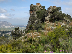
Castell de l’Ocaive, L’Era de Raboses, Font Coberta circuit.
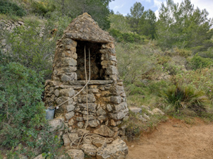
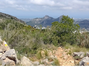
Begin along a path beside an old waterpipe (asequia),enjoy some all round views from mostly well marked and preserved paths and tracks, an optional visit up to the restored castle, a large era and several fonts ‘ en route ‘ and a downhill return.
Spanish maps included within these descriptions are provided courtesy of the Spanish IGN and remain © Instituto Geográfico Nacional.
OSM (OpenStreetMap) and OCM (OpenCycleMap) maps are © OpenStreetMap Contributors. The OSM project welcomes contributions from all to enrich the map data, which is made freely available. Land (Thunderforest Landscape) maps are © Thunderforest based on data © OpenStreetMap contributors.
The grade of this walk is MS/C, which means
MS – Moderately Strenuous: Up to 600 metres ascent and/or no more than 15 km in length with some rough going taken at a reasonable pace.
C – More than half the route on rough ground.
| Nearest town | Pedreguer |
| Directions to start |
Park at Ermita San Blai.CV720 Alcalali to Pedreguer road at Tourist sign to Ermita at edge of village, turn into Avenida de Maria Lopez and go to far end of road (over several junctions) and then turn R to park near Ermita beside open ground. |
| Start point (Lat/Long) | 38.790720, 0.033728 Click here to view in Google Maps (in a new browser tab) |
| Length (km) | 11.00 |
| Ascent (metres) | 590 |
| Walking time (hours) | 4 |
| Total time (hours) | 4.66 |
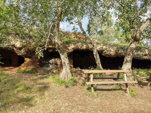
| Recommendations or Restrictions | Walk description visits Ocaive castle, extra time will be needed to visit any of the Fonts. |
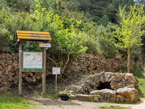
Download walk descriptionDownload GPS file

Comments
Castell de l’Ocaive, L’Era de Raboses, Font Coberta circuit. — No Comments
HTML tags allowed in your comment: <a href="" title=""> <abbr title=""> <acronym title=""> <b> <blockquote cite=""> <cite> <code> <del datetime=""> <em> <i> <q cite=""> <s> <strike> <strong>