
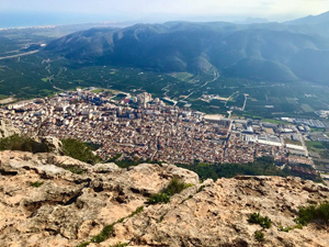
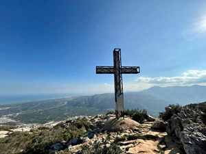
Alt de la Creu
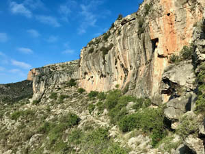
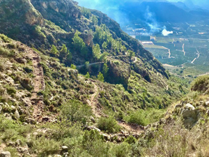
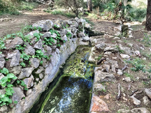
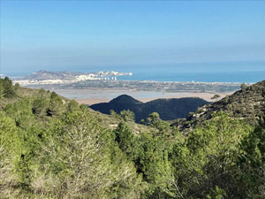
A circuit over the Alt de la Creu. Taking the way of the Borregos (sheep) and a section of mozarabic zig-zags then via ‘Font de la Sangonera’ to reach the summit, Mirador & principle Cross (there are two others). Descending via Fontetes Cantus’. Interesting terrain, with wide ranging views.
Generally good marked paths, with some steep & rough sections.
Spanish maps included within these descriptions are provided courtesy of the Spanish IGN and remain © Instituto Geográfico Nacional.
OSM (OpenStreetMap) and OCM (OpenCycleMap) maps are © OpenStreetMap Contributors. The OSM project welcomes contributions from all to enrich the map data, which is made freely available. Land (Thunderforest Landscape) maps are © Thunderforest based on data © OpenStreetMap contributors.
The grade of this walk is MS/C, which means
MS – Moderately Strenuous: Up to 600 metres ascent and/or no more than 15 km in length with some rough going taken at a reasonable pace.
C – More than half the route on rough ground.
| Nearest town | Tavernes de la Valldigna |
| Directions to start |
From AP-7. Follow CV-50 through Tavernes. Pass the large brick library, with mural. Go straight on at the roundabout, then turn second right into ‘Carrer del Cantalot’. Drive to the far end of the road and park at side of road just before a pylon. |
| Start point (Lat/Long) | 39.071390, -0.276040 Click here to view in Google Maps (in a new browser tab) |
| Length (km) | 10.00 |
| Ascent (metres) | 600 |
| Walking time (hours) | 4 |
| Total time (hours) | 5.5 |
| Recommendations or Restrictions | Including either or both of the options, will raise the grade to S/C. |
Download walk descriptionDownload GPS file
Comments
Alt de la Creu — No Comments
HTML tags allowed in your comment: <a href="" title=""> <abbr title=""> <acronym title=""> <b> <blockquote cite=""> <cite> <code> <del datetime=""> <em> <i> <q cite=""> <s> <strike> <strong>