
Azafor/La Safor, L’ Orxa, Riu Serpis circuit
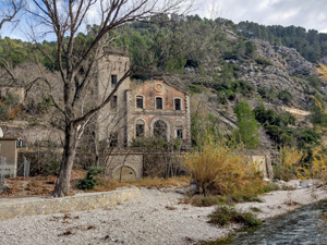
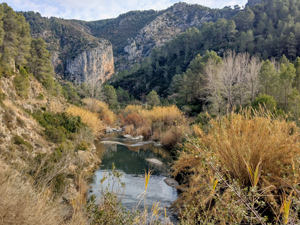
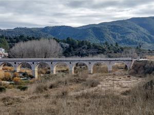
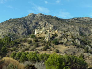
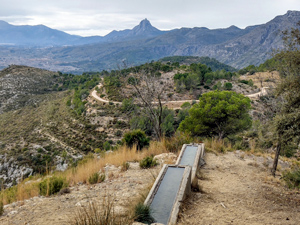
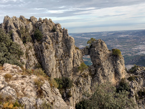
A challenging,interesting and varied walk including a Nevera, woodland paths, a Font, a cave, an historic bridge, a castle, a beautiful gorge, old railway tunnels, a waterfall, extensive views and tranquil riverside.
Spanish maps included within these descriptions are provided courtesy of the Spanish IGN and remain © Instituto Geográfico Nacional.
OSM (OpenStreetMap) and OCM (OpenCycleMap) maps are © OpenStreetMap Contributors. The OSM project welcomes contributions from all to enrich the map data, which is made freely available. Land (Thunderforest Landscape) maps are © Thunderforest based on data © OpenStreetMap contributors.
The grade of this walk is VS/C/X, which means
VS – Very Strenuous: More than 800 metres ascent and/or more than 20km in length with steep, loose or heavily vegetated sections.
C – More than half the route on rough ground.
X – Experienced walkers route: the route requires considerable stamina and/or significant scrambling skills on rough, steep or exposed sections.
| Nearest town | Villalonga |
| Directions to start |
From CV680 in Villalonga near Mercadona roundabout, take exit on R (Av. Blasco Ibanez) then at next small roundabout across onto Via Pista continue for approx. 3 kms. and just after a large quarry park near PR/Via info board. |
| Start point (Lat/Long) | 38.875321, -0.243352 Click here to view in Google Maps (in a new browser tab) |
| Length (km) | 24.50 |
| Ascent (metres) | 1075 |
| Walking time (hours) | 6.5 |
| Total time (hours) | 7.5 |
| Recommendations or Restrictions | Section *** /*** can be car shuttle to make a less demanding day (shortens by 3.7km /380mtr.ascent) the Cim is also optional. |
Download walk descriptionDownload GPS file
Comments
Azafor/La Safor, L’ Orxa, Riu Serpis circuit — No Comments
HTML tags allowed in your comment: <a href="" title=""> <abbr title=""> <acronym title=""> <b> <blockquote cite=""> <cite> <code> <del datetime=""> <em> <i> <q cite=""> <s> <strike> <strong>