
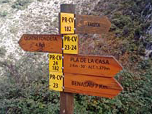
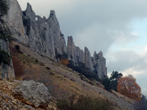
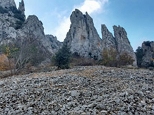
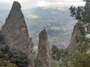
Els Frares – Serrella Ridge
A tough winding ascent leads upwards and through these impressive rock pinnacles ‘ Els Frares ‘ then up on to the Serrella ridge and return down the valley below Pla de la Casa.
Spanish maps included within these descriptions are provided courtesy of the Spanish IGN and remain © Instituto Geográfico Nacional.
OSM (OpenStreetMap) and OCM (OpenCycleMap) maps are © OpenStreetMap Contributors. The OSM project welcomes contributions from all to enrich the map data, which is made freely available. Land (Thunderforest Landscape) maps are © Thunderforest based on data © OpenStreetMap contributors.
The grade of this walk is VS/C/Scr, which means
VS – Very Strenuous: More than 800 metres ascent and/or more than 20km in length with steep, loose or heavily vegetated sections.
C – More than half the route on rough ground.
Scr – Scrambling: This implies the need for handholds to ascend steep rock pitches with a sense of exposure to vertigo and where a slip could lead to a serious accident.
| Nearest town | Facheca |
| Directions to start |
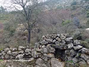
From Jnc 62 on the AP7 motorway go through Pedreguer and take the CV720 W. After some time in Facheca take a L turn signed Quatretondeta and then almost immediately turn L and follow up to end of surfaced road and park near a ruin. |
| Start point (Lat/Long) | 38.727930, -0.272200 Click here to view in Google Maps (in a new browser tab) |
| Length (km) | 14.50 |
| Ascent (metres) | 950 |
| Walking time (hours) | 5 |
| Total time (hours) | 6 |
| Recommendations or Restrictions | Some hand scrambling skills needed |
Download walk descriptionDownload GPS file
Comments
Els Frares – Serrella Ridge — No Comments
HTML tags allowed in your comment: <a href="" title=""> <abbr title=""> <acronym title=""> <b> <blockquote cite=""> <cite> <code> <del datetime=""> <em> <i> <q cite=""> <s> <strike> <strong>