
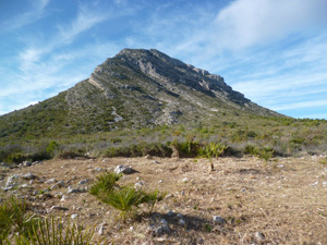
Eye of Montgo from Las Rotas
A challenging walk with interesting features and beautiful views. The route includes all types of terrain including scrambling, chains, tricky rocky paths, wide gravel paths and even some tarmac. We start by viewing the sea caves from the viewpoint above (not going into the caves), then going steeply up to the windmills, continuing up to the Eye of Montgo and back again via the coastal watchtower.
Spanish maps included within these descriptions are provided courtesy of the Spanish IGN and remain © Instituto Geográfico Nacional.
OSM (OpenStreetMap) and OCM (OpenCycleMap) maps are © OpenStreetMap Contributors. The OSM project welcomes contributions from all to enrich the map data, which is made freely available. Land (Thunderforest Landscape) maps are © Thunderforest based on data © OpenStreetMap contributors.
The grade of this walk is MS/C, which means
MS – Moderately Strenuous: Up to 600 metres ascent and/or no more than 15 km in length with some rough going taken at a reasonable pace.
C – More than half the route on rough ground.
| Nearest town | Denia |
| Directions to start |
Turn off the Denia-Javea CV736 at Km1.5 from Denia onto the CV7340 towards Las Rota (Les Rotes in Valencian). Continue to the end of the road. |
| Start point (Lat/Long) | 38.824363, 0.156865 Click here to view in Google Maps (in a new browser tab) |
| Length (km) | 15.00 |
| Ascent (metres) | 500 |
| Walking time (hours) | 4.00 |
| Total time (hours) | 5.00 |
| Recommendations or Restrictions | The footpaths can be very rocky and tough on the feet. |
Download walk descriptionDownload GPS file


Comments
Eye of Montgo from Las Rotas — No Comments
HTML tags allowed in your comment: <a href="" title=""> <abbr title=""> <acronym title=""> <b> <blockquote cite=""> <cite> <code> <del datetime=""> <em> <i> <q cite=""> <s> <strike> <strong>