
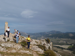
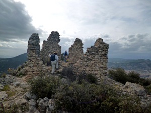
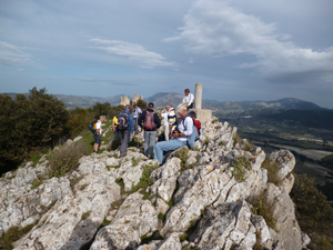
La Serreta
A pleasant walk to a rocky summit with interesting ancient ruins.
Spanish maps included within these descriptions are provided courtesy of the Spanish IGN and remain © Instituto Geográfico Nacional.
OSM (OpenStreetMap) and OCM (OpenCycleMap) maps are © OpenStreetMap Contributors. The OSM project welcomes contributions from all to enrich the map data, which is made freely available. Land (Thunderforest Landscape) maps are © Thunderforest based on data © OpenStreetMap contributors.
The grade of this walk is M/A, which means
M – Moderate: up to 12km in length, less than 400 metres ascent and less than 50% rough going.
A – All on good tracks
| Nearest town | Alcoy |
| Directions to start |
From junction 443 on the A7 near Alcoy take the CV70 towards Benilloba. Approx 700m after the juntion with a road towards Alicante look out for a forest track on the RHS with a No Entry sign. Turn up here and park on the LHS after 20m. |
| Start point (Lat/Long) | 38.689386, -0.449796 Click here to view in Google Maps (in a new browser tab) |
| Length (km) | 5.80 |
| Ascent (metres) | 270 |
| Walking time (hours) | 1.50 |
| Total time (hours) | 2.00 |
| Recommendations or Restrictions |
Download walk descriptionDownload GPS file
In January 2025 we found a padlocked chain across the forest road at the junction with the cv70. There was only space to squeeze one car into a safe position. No notices were on display to indicate if it was a permament feature.