
Maigmo circuit avoiding the summit
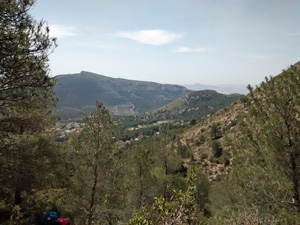
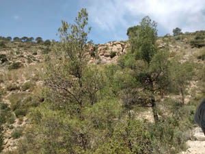
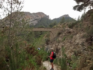
A circuit up to a col. below the summit, around the back of the mountain to reach the other col. and back down. After a leisurely start there’s a tough ascent to the first col. but the rest is fine. Mostly on tracks and well defined paths with a short distance on quiet roads. Absolutely stunning views.
Spanish maps included within these descriptions are provided courtesy of the Spanish IGN and remain © Instituto Geográfico Nacional.
OSM (OpenStreetMap) and OCM (OpenCycleMap) maps are © OpenStreetMap Contributors. The OSM project welcomes contributions from all to enrich the map data, which is made freely available. Land (Thunderforest Landscape) maps are © Thunderforest based on data © OpenStreetMap contributors.
The grade of this walk is S/B, which means
S – Strenuous: More than 600 metres ascent and/or more than 15km in length with steep, loose or heavily vegetated sections.
B – Less than half the route on rough ground.
| Nearest town | Agost |
| Directions to start |
Travelling from Alicante to Alcoy on the A7 exit at junction 481 onto the CV827 to Agost. At approx. km 4.5 park on the hardstanding on the LHS of the road. |
| Start point (Lat/Long) | 38.478642, -0.638453 Click here to view in Google Maps (in a new browser tab) |
| Length (km) | 16.00 |
| Ascent (metres) | 617 |
| Walking time (hours) | 4.25 |
| Total time (hours) | 6.00 |
| Recommendations or Restrictions | None |
Download walk descriptionDownload GPS file


Comments
Maigmo circuit avoiding the summit — No Comments
HTML tags allowed in your comment: <a href="" title=""> <abbr title=""> <acronym title=""> <b> <blockquote cite=""> <cite> <code> <del datetime=""> <em> <i> <q cite=""> <s> <strike> <strong>