
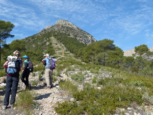
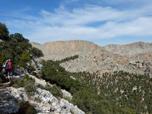
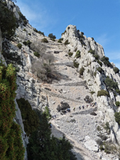
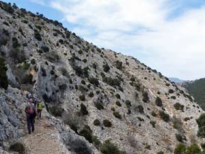
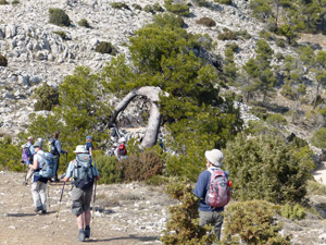
Morron de Alham via caracol
A delightful walk along an open ridge with a stiff climb up a fire-break followed by an enchanting track up towards the summit of the ridge. Return via woodland tracks.
Spanish maps included within these descriptions are provided courtesy of the Spanish IGN and remain © Instituto Geográfico Nacional.
OSM (OpenStreetMap) and OCM (OpenCycleMap) maps are © OpenStreetMap Contributors. The OSM project welcomes contributions from all to enrich the map data, which is made freely available. Land (Thunderforest Landscape) maps are © Thunderforest based on data © OpenStreetMap contributors.
The grade of this walk is S/B, which means
S – Strenuous: More than 600 metres ascent and/or more than 15km in length with steep, loose or heavily vegetated sections.
B – Less than half the route on rough ground.
| Nearest town | El Berro |
| Directions to start |
Leave El Berro to the S on the Calle Juan Batista and drive past the Casa Forestal Quemados. At the T-jnc, turn R. At the next jnc, turn R again signed to La Perdiz. Park in the Zona Recreative car park on the RHS at La Perdiz. |
| Start point (Lat/Long) | 37.868857, -1.520834 Click here to view in Google Maps (in a new browser tab) |
| Length (km) | 14.00 |
| Ascent (metres) | 800 |
| Walking time (hours) | 4.25 |
| Total time (hours) | 6.00 |
| Recommendations or Restrictions | None – but note GPS track omits summit. |
Download walk descriptionDownload GPS file
Thank you for this route! We walked this track yesterday (18th of June ‘18) and it was amazing. Especially the first part was really tough (and hot), but also really beautiful. It took us 5 hours and we didn’t see anybody else the whole way (except wild sheep/goats, squirrels and lizards).
The only difficulty is that the first half of the route is hard to recognize path-wise. I brought a local map, but it didn’t feature those small tracks, so I would say a GPS is necessary. Thanks again, it was one of the best hikes I did.