
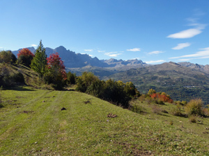
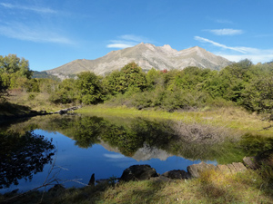
On the slopes of Puntal de los Petros
A lower level exploration with 360 degree views from pastures easily reached. An initially challenging return route gives way to braid forest tracks and then gentle footpaths through forest.
Spanish maps included within these descriptions are provided courtesy of the Spanish IGN and remain © Instituto Geográfico Nacional.
OSM (OpenStreetMap) and OCM (OpenCycleMap) maps are © OpenStreetMap Contributors. The OSM project welcomes contributions from all to enrich the map data, which is made freely available. Land (Thunderforest Landscape) maps are © Thunderforest based on data © OpenStreetMap contributors.
The grade of this walk is MS/B, which means
MS – Moderately Strenuous: Up to 600 metres ascent and/or no more than 15 km in length with some rough going taken at a reasonable pace.
B – Less than half the route on rough ground
| Nearest town | Panticosa |
| Directions to start |
Reach Panticosa by travelling up the N260a from the south if coming N from Huesca and continuing up the A136. Past the reservoir take the turning R towards the village and at the roundabout turn R. Start at the first ski-station car park at the southern end of the village and at the bottom of the hill. |
| Start point (Lat/Long) | 42.721931, -0.281099 Click here to view in Google Maps (in a new browser tab) |
| Length (km) | 10.00 |
| Ascent (metres) | 540 |
| Walking time (hours) | 3.00 |
| Total time (hours) | 3.75 |
| Recommendations or Restrictions | Some parts of the high level track can be very muddy and wet because of cattle use. |
Download walk descriptionDownload GPS file


Comments
On the slopes of Puntal de los Petros — No Comments
HTML tags allowed in your comment: <a href="" title=""> <abbr title=""> <acronym title=""> <b> <blockquote cite=""> <cite> <code> <del datetime=""> <em> <i> <q cite=""> <s> <strike> <strong>