
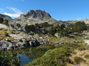
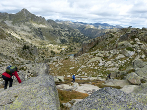
Pic d’Amitges from Puerto de la Bonaigua
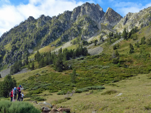
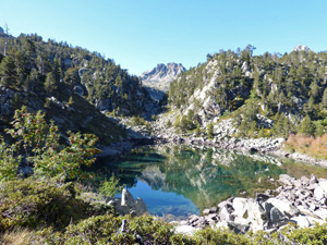
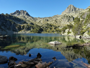
A demanding walk and scramble to a pyrenean summit in amongst dramatic and beautiful scenery.
Spanish maps included within these descriptions are provided courtesy of the Spanish IGN and remain © Instituto Geográfico Nacional.
OSM (OpenStreetMap) and OCM (OpenCycleMap) maps are © OpenStreetMap Contributors. The OSM project welcomes contributions from all to enrich the map data, which is made freely available. Land (Thunderforest Landscape) maps are © Thunderforest based on data © OpenStreetMap contributors.
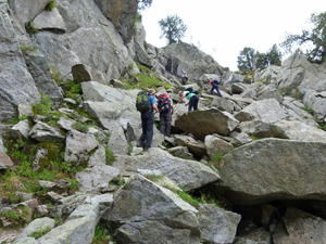
The grade of this walk is VS/C/Scr, which means
VS – Very Strenuous: More than 800 metres ascent and/or more than 20km in length with steep, loose or heavily vegetated sections.
C – More than half the route on rough ground.
Scr – Scrambling: This implies the need for handholds to ascend steep rock pitches with a sense of exposure to vertigo and where a slip could lead to a serious accident.
| Nearest town | Baquiera |
| Directions to start |
From Vielha drive E on the C28. Drive over the Puerto de la Bonaigua and descend to where there are some severe bends with a large car park on either side of the road. Park in the lowest of these on the W side of the road at 1900m. Drive to the end of the car park nearest the ski lift. |
| Start point (Lat/Long) | 42.654059, 0.999535 Click here to view in Google Maps (in a new browser tab) |
| Length (km) | 15.20 |
| Ascent (metres) | 1182 |
| Walking time (hours) | 5.00 |
| Total time (hours) | 8.50 |
| Recommendations or Restrictions | Only for experienced navigators and mountaineers |
Download walk descriptionDownload GPS file
Comments
Pic d’Amitges from Puerto de la Bonaigua — No Comments
HTML tags allowed in your comment: <a href="" title=""> <abbr title=""> <acronym title=""> <b> <blockquote cite=""> <cite> <code> <del datetime=""> <em> <i> <q cite=""> <s> <strike> <strong>