
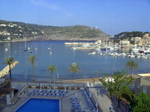
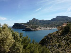
Port de Sóller – Sóller circuit (anticlockwise)
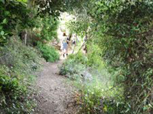
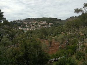
A lovely straightforward walk over the hills from Port de Sóller to Sóller, with great views over the countryside. Return from Sóller via wooded paths through orange and lemon orchards.
Can be shortened by 6 km by taking public transport back to Port de Sóller.
Spanish maps included within these descriptions are provided courtesy of the Spanish IGN and remain © Instituto Geográfico Nacional.
OSM (OpenStreetMap) and OCM (OpenCycleMap) maps are © OpenStreetMap Contributors. The OSM project welcomes contributions from all to enrich the map data, which is made freely available. Land (Thunderforest Landscape) maps are © Thunderforest based on data © OpenStreetMap contributors.
The grade of this walk is S/B, which means
S – Strenuous: More than 600 metres ascent and/or more than 15km in length with steep, loose or heavily vegetated sections.
B – Less than half the route on rough ground.
| Nearest town | Puerto de Soller |
| Directions to start |
You can start this walk anywhere along the seafront of Port de Sóller, although the description and GPS track assume a start near the bridge over the Torrent Major river bed. |
| Start point (Lat/Long) | 39.790847, 2.694393 Click here to view in Google Maps (in a new browser tab) |
| Length (km) | 17.50 |
| Ascent (metres) | 524 |
| Walking time (hours) | 4.5 |
| Total time (hours) | 7 |
| Recommendations or Restrictions | None |
Download walk descriptionDownload GPS file
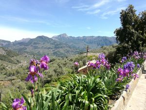
Beautiful route with several different sections, which highlight the beauty and diversity of Soller and Port de Soller walking trails.