
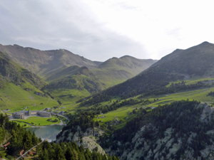
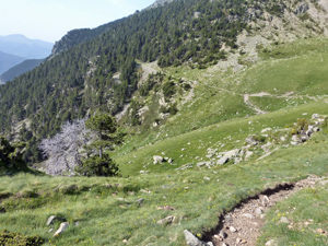
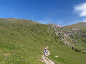
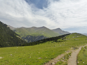
Queralbs from Nuria via Font d’Alba
A high level traverse across the face of Puigmal and down to the Riu de Tosa before returning to Queralbs.
Spanish maps included within these descriptions are provided courtesy of the Spanish IGN and remain © Instituto Geográfico Nacional.
OSM (OpenStreetMap) and OCM (OpenCycleMap) maps are © OpenStreetMap Contributors. The OSM project welcomes contributions from all to enrich the map data, which is made freely available. Land (Thunderforest Landscape) maps are © Thunderforest based on data © OpenStreetMap contributors.
The grade of this walk is MS/B, which means
MS – Moderately Strenuous: Up to 600 metres ascent and/or no more than 15 km in length with some rough going taken at a reasonable pace.
B – Less than half the route on rough ground
| Nearest town | Queralbs |
| Directions to start |
The start can only be reached by using the rack railway that starts in Ribes de Freser and stops at Queralbs where there is a large car park at the station. Cost in 2019 was €19.50 return. |
| Start point (Lat/Long) | 42.397541, 2.154548 Click here to view in Google Maps (in a new browser tab) |
| Length (km) | 16.00 |
| Ascent (metres) | 350 |
| Walking time (hours) | 4.66 |
| Total time (hours) | 6.5 |
| Recommendations or Restrictions | Beware the substantial amount of descent! |
Download walk descriptionDownload GPS file
Comments
Queralbs from Nuria via Font d’Alba — No Comments
HTML tags allowed in your comment: <a href="" title=""> <abbr title=""> <acronym title=""> <b> <blockquote cite=""> <cite> <code> <del datetime=""> <em> <i> <q cite=""> <s> <strike> <strong>